This article presents a historical analysis of the various constructions built on the ancient overland Hajj route from Iraq to Makkah and the role of Lady Zubayda with especial reference to her Makkah water projects.

Figure 1. Map of Zubaydah Hajj Route indicating the various service stations from Kufa to Makkah. (From Sami. A. Al-Maghlouth, Atlas of Hajj & Umra (Arabic). (Source)
There were three main historic pilgrimage routes connecting Makkah with Iraq, Egypt and Al-Andalus. The Baghdad (Darb Zubayda) or Zubayda Overland Route, was one of the most important It is named after Zubayda bint Jafar wife of the Abbasid Caliph Harun al-Rashid for her extensive charitable works on the numerous stations along the trail.
The origin of the trail dates back to the pre-Islamic era and was known as Darb Al-Heera (Al-Heera Road) used by traders and travellers between Al-Heera (Iraq) and Makkah. It was profoundly modified in the Islamic era when its architecture was developed from Iraq to Makkah in a manner unprecedented in history. Its importance greatly increased with the dawn of Islam, and the route flourished during the time of the early caliphate. Zubayda Road acquired its best of care during the Abbasid Caliphate 132-656 AH / 749-1258 CE, when stations provided with wells, pools, dams, palaces and houses were built and signposts, milestones and pavements were installed that made it safe and easily accessible.
It was referred to by sources in different Islamic eras, in the Rashidun era. During the era of Caliph Omar ibn Al-Khattab Basra and Kufa were linked with safe land routes. Abu Musa al-Ash’ari governed Al-Basra in the year 17 AH/638 CE, then he dug wells along the road from Basra to Makkah. During the succession of Caliph Othman ibn Affan, wells were dug in Faid area. Abdullah bin Amer governed Al-Basra and carried out countless works on the road from Basra to Makkah, creating the stations of Al- Nbaj, Qariyatain and Bustan Bani Amer[1].
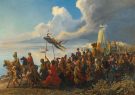
In the Umayyad era, the road continued to be used for the purposes of trade and pilgrimage. It is the same road that Imam Hussein and his companions took in their famous tragic journey from Makkah to Iraq.

Figure 2. A narrow part of Zarb Zubaydah leading to Field Station 120Km east of Hail. (Source)
The road marked the golden era during the Abbasid rule as the most important link between Baghdad and the two holy mosques in Makkah and Medina. The Abbasid caliphs focused on the road by providing it with multiple services, such as building water tanks, digging wells, establishing ponds, constructing lighthouses that guide travellers and rest houses.
This paper sheds light on the significance of the road particularly to pilgrims from the Islamic East Countries passing through Iraq. It also examines the historical stages it went through.
There are many Arabic studies that have dealt with the road with research, according to what we know, with an explicit title, including the book of Muhammad Al-Muallim entitled Al-Darb Al-Sultani (The Road of the Sultans), the research of Abdul Sattar Al-Azzawi entitled Tareeq Al-Hajj Al-Qadeem Wa Muhimmat Ihya’ih (The Old Hajj Road and the Mission for its Revival), and Sulayman Abdul Ghani Maliki’s Tareek Rakb Al-Hajj Al-Iraqi (the Road of the Iraqi Hajj Caravan from Kufa to Makkah).
Some books contain sections on the subject, including Sayyid Abdul Majeed Bakr’s Al-Malaamih Al-Goghrafiya Li Duroob Al-Hajeej (the Geographical Features of the Pilgrims’ Roads), as well as some university theses, such as Nizar Aziz Habib Mahmoud’s Khadamat Al-Hajeej 132-334 AH (the pilgrims’ services in the Abbasid Era), and Shahla Mamur Khashin Al-Azzawi’s Zubayda Um Al-Amin and Melik M M Al-Khayyat’s Al-Sayyida Zubayda wa-Dawruha Al-Siyasi Wal Umrani (Lady Zubayda and her Political and Urban Role).
There are a number of works on the subject in English, the most recent is by Saad Rashid[2].
Those studies confirmed that naming and associating the pilgrimage road that linked Iraq to Hijaz with Zubayda, was because her efforts in serving the pilgrims on the road, were superior to those who preceded her. However, in this author’s view, that reason was not sufficient on its own. This paper examines Zubayda’s work both on the road and on Makkah water.
The main topics this research covers are:

Figure 3. Octagonal pond , near Fied station close to Hail, paved with marble for use by workers residing in a nearby castle. (Source)
Caring for the Hajj roads was not a new task to the Caliphate, as Hajj lies at the core of its duties. It is related to performing one of the five pillars of Islam, in addition to the political importance of the Hajj season. Al-Yaqoobi said:
“The caliphate is only valid for those in whose hands are the Two Sacred Sanctuaries and for those who performed Hajj with the people” [3]
This phrase bears many indications of the importance of the Emirate (Authority) of Hajj to the Caliphate in political terms.
From the religious and political point of view, the caliphs were keen to facilitate the pilgrims’ access to the holy lands by providing security, services and all possible means of comfort in the pilgrimage roads, hoping for a reward from God Almighty, and for the good remembrance by Muslims.
One of those roads is that connects Iraq with Hijaz, which is the Ancient Hajj Road, known before Islam as (al-Hira-Makkah Road), through which the trade takes place between Makkah and Iraq[4].

Figure 4. Typical furnace for melting Tar rocks for use on the road. (Source)
After the city of Kufa was established during the reign of Caliph Omar bin al-Khattab, the road went on linking Iraq with the Holy Land, known as Kufa-Makkah-Medina Road. It was used after the conquest of Iraq and the spread of Islam in the East and it flourished since the era of the Rashidun (Rightly guided) Caliphates[5].
In the Umayyad era, the road went on to be taken by pilgrims and travellers. It is the same road that Imam Al-Hussein and his companions took when he left Makkah for Iraq[6]. Then Caliph Yazid bin Abd Al-Malik ordered his administrator in Kufa, Omar ibn Hubayra[7] in 104 AH / 722 CE to pave the road, to build stations there and to dig wells[8].
In the Abbasid era, the road became the most important link between Baghdad and Makkah, reaching the two Holy Mosques in Makkah and Medina. The Abbasid caliphs took care of this road, providing it with multiple services, such as constructing water tanks, digging wells, constructing ponds, and building up lighthouses that guide travellers. In the early days of the Abbasid rule, Abu Al-Abbas Al-Saffah ordered the governor of Kufa, Issa ibn Musa[9]. to build milestones along the road from Kufa to Makkah in the year 134 AH / 751 CE[10]. He built some houses on the road from Al-Qadisiyah[11] to Zabala[12].

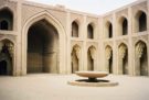
Figure 5. Field service station; one of the largest on Darb Zubaydah. It has a palace used by visiting Abbasid caliphs. (Source)
The road he paved was sign-posted after him by Caliph Al-Mahdi. In 136 AH / 753 CE, Abu Muslim al-Khurasani[13] repaired the Hajj Road and granted gifts to the dwellers residing along[14].
When Abu Jafar Al-Mansur performed Hajj in 137 AH / 754 CE, he ordered the repair of the wells and maintenance of the road[15]. Whilst on Hajj in 140 AH / 757 CE, he distributed donations to the dwellers and ordered the construction of mosques. On his Hajj in 148 AH / 765 CE, he ordered the repair of the wells on the road. One of the palaces attributed to him is a mile and a half away from Al-Khuzaymiyya[16], known as the Ancient Palace. It had a square pond and a water tank[17]. At Al-Umq[18] region there is a palace, a mosque and several wells, the most famous of which is Al-Khadhra, known to have been built for Abu Jafar Al-Mansur[19].
Meanwhile, in 161 AH/777CE, Caliph Al-Mahdi ordered to construct palaces and ponds between Kufa and Zabala as well as refurbishing milestones and providing security. He instructed his son Musa Al-Hadi (166 AH/782 CE) to pave the road and distribute gifts to the dwellers on the road. He was particularly interested in mail[20] between Baghdad and Hijaz. One of the palaces attributed to him is in Zabala. Among the ponds that he built[21] was a particularly spacious one in Al-Ajfar[22].
Caliph Harun al-Rasheed also ordered the construction of water reservoirs, digging wells, and building forts along the road[23]. He had installed signposts between stations and palaces[24], providing each location with public facilities. He performed Hajj in 170 AH / 786 CE after he was pledged allegiance to be a caliph. He renovated the road, dug wells and distributed funds to the Bedouins along the way. Al-Rasheed repeated Hajj in 173AH/789 CE, and in 177AH/ 793 CE he performed Hajj on foot. An especially long canopy was stretched to shade him[25].
In 212 AH / 827 CE, Caliph Al-Ma’mun performed Hajj, distributed funds to the residents on the road whereas palaces were built for his comfort along the journey[26].
In 240 AH/854 CE, Caliph Al- Mutawakil ordered the repair of the road but also to illuminate with wax candles. The caravans were equipped with easy-to-carry oil[27].
Caliph Athud al-Dawla, 369 AH / 979 CE, ordered the repair of the road and the refurbishing and re-digging of wells the road as well as distributing donations to the Bedouin dwellers[28].
The Abbasid caliphs appointed governors to oversee the road’s maintenance, refurbishment and security. The employee in charge of the factories[29] was responsible before the caliph for providing water for pilgrims and travellers coming from Khurasan and from desert areas beyond the river[30], They also appointed a dedicated Emir (Commander), called the prince of the road to Makkah[31]. The Emir’s mission was to lead the pilgrimage caravan of Iraq, and the pilgrims of Khurasan and the East, accompanied by guards dispatched by the caliph. The guards often carry out his command because that emir was appointed directly by the caliph, and one who would have had a long service in the Caliphate Palace[32].
Women had their share of interest in that road. For example, Al-Harbi reported that Al-Khayzaran erected a station in her name, located four miles from the area of Zabala[33]. Khalisa, the maid of Khayzaran, paved the road[34] and constructed two stone sidewalks to ease passage when muddied by rain[35]. Al-Harbi also mentioned that Khalisa bought one hundred slaves and said to them:
“Carry stones to pave two sides from Al-Ajfar to Al-Manzil. Once you are done you all are free”[36]
Three miles and a half away there are domes built for Khalisa[37]. At a distance of eight miles from Battan[38], there are two ponds for Khalisa called Al-Tanahi and Al-Kharaba[39] and a third one carrying her name in Al-Thalabiyya Area[40].
The name of Zubayda was associated with the road for her distinctive construction works on. So, the road was known by the name Darb Zubayda[41] (Zubayda’s Road). Historical sources mentioned the word Al-Zubaydiyya referring to the ponds that Lady Zubayda constructed on the road, including Al-Zubaydiyya Al-oolah (Zubaydiyya the first) located between Al-Mughitha[42] and Al-Uthayb[43], Al-Zubaydiyya the second (between Al-Mughitha and Al-Qara’[44]), Al-Haytham[45] (between Al-Qa’[46] and Zabala), Al-Rustumiyya[47] (between Al-Shuqooq[48] and Qabr Al-Abadi’s[49]), Al-Qunay’a (between Al-Tha’labiyya [50] and Al Khuzaymiyyah), Birkat Al-Anaba (between Toz[51] and Sumayra [52]), and Qurura [53] (between Al-H’ajir [54] and Al-Nuqra[55]).
In addition to the ponds, Lady Zubayda built in each of these locations (Zubaydiyyat) a palace and a mosque. Thus, she performed complete services for pilgrims who used that road[56]. Some of the names of ponds, wells, and sites that were built to endure the hardship of pilgrimage to Makkah by land, acquired contemporary names after they became inhabited [57].
It is worth noting that the ancient land pilgrimage road Darb Zubayda reached its golden age in the first Abbasid era. However, after the time of the powerful caliphs had passed, security on the Hajj road was lost exposing pilgrims to attacks. At the end of the 3rd century AH and the beginning of the 4th century, some of the road stations were exposed to danger. Pilgrims suffered attacks, plunder, and looting. Consequently, the pilgrims stopped using it, except when protection was provided [58].
After the achievements of Lady Zubayda, there was no tangible care by the late Abbasid caliphs, except for Caliphs Al-Ma’mun 212 AH / 827 CE, Al-Mutawakkil Alallah 240 AH / 854CE and finally Athud Al-Dawla in 369 AH / 979 CE.
Political problems and divisions inside the Abbasid Caliphate deflected attention away from road maintenance. The neglect caused pilgrims to suffer thirst and hardship. For example, in 228 AH /843 CE, people suffered from hot weather and Bedouins on the road sold water at an extortionate price, but the caliph then did not take any action. In 357 AH / 967CE many pilgrims perished on the way due to the lack of water. In 395 AH / 1004CE the pilgrims faced strong winds and thirst[59].
After the fall of Baghdad by the Mongols in 656 AH / 1258 CE, the pilgrimage convoy from Iraq was suspended for ten years[60] and most of its stations perished.

Figure 6. A pond near the Field service station still serves nearby inhabitants who raise their hands in prayer for Zubaydah whenever they take water from it. (Source)
Lady Zubayda bint Jafar bin Al-Mansur 145 – 216 AH / 764-831 CE, was the wife of the Abbasid Caliph Harun al-Rashid. Historical sources disputed her name. The most reliable is Amat al-Aziz (or Um al-Aziz)[61] bint Jafar bin Abi Jafar al-Mansur Abdullah bin Muhammad bin Ali bin Abdullah bin Abbas bin abdul-Muttalib, the uncle of Prophet Muhammad[62].
Her nickname was Um Jafar. She was nicknamed Zubayda by her grandfather, Caliph Abu Jafar al-Mansur, who used to pamper her as a child by calling her Zubayda (meaning the essence of Butter), and she became famous with that name ever since[63].
Harun al-Rashid married her in 165 AH / 782 CE, in a historic marriage ceremony, during the reign of Caliph Al-Mahdi in Baghdad[64]. She was the mother of Caliph Al-Amin. She died in 216 AH / 831 AD[65]. She was famous for her extensive philanthropy and in particular for her work on the Iraq Makkah road and the construction of aqueducts bringing water from aquifers to Makkah, known as Zubayda’s spring, which is still running to the present day.

Figure 7. A pond close to Makkah (Source)
The researcher of Abbasid history will find the name of Lady Zubayda mentioned repeatedly in the events of that era. She was able to immortalize her name through charities which she was ordered to accomplish on the Hajj Road that connected the metropolis of the Abbasid Caliphate with Hijaz, in addition to her deeds in Makkah and Medina.
Perpetual charities continued even after her death, and that care came from her repeated pilgrimages from the city of Baghdad to Makkah. She considered the sufferings of the pilgrims on that road, despite all the services provided by the Abbasid Caliphate then.
Lady Zubayda performed Hajj more than once with her husband, Caliph Harun Al-Rashid. Her first Hajj was in 173 AH / 790CE[66], then she did Hajj in 175 AH / 792 CE[67]. During that Hajj, she considered the water shortage in Makkah, so she ordered to drill wells on her own expense.
Then she performed Hajj in 176 AH / 793 CE[68], during which Lady Zubayda was interested in establishing workshops and ponds on the Hajj Road. Then she performed Hajj in 180 AH / 797 CE[69], and went to Makkah on foot with her husband Al-Rashid[70]. Rugs were being spread under their feet. In each Farsakh (4-6km) a dome was erected for them equipped with all amenities. After every four Farsakhs they would go down to a palace in which they would spend a day[71]. With all the amenities provided, she must have felt the sufferings of the poor pilgrims who went to Makkah without such provisions and amenities.
Then she performed Hajj in 186 AH / 803CE[72], and in 190 AH / 807 CE[73], then in 193 AH / 808 CE[74], and in 208 AH / 823 CE[75], and her last was in 211 AH / 826 CE[76].
It seems clear that Lady Zubayda’s frequent pilgrimage and her awareness of the hardships of the road, the scarcity of water along the road and especially in the Grand Mosque in Makkah, prompted her dedication to resolve these issues as a fulfilment of her charitable obligations.

Figure 8. A station built by Zubaydah to serve pilgrims coming from Yemen and Central Arabia after passing through Taif. Today is known as Al- Kharabah palace. Its water comes through canals (Source)
When the caravans of pilgrims used to depart from city centres, as caravans gather from nearby areas. Those areas witness celebrations after which the caravans set off through the land routes that connect them with the Holy Land, taking into account the sufficient time for that journey to ensure a timely arrival, in terms of distance, rest times, and road hazards. It is customary for the caravans to leave at the beginning of the lunar month Zul-Qi’da to the regions near Makkah, and in the lunar month of Shawwal, if the intention was to visit Medina before travelling to Makkah[77].

Figure 9. Remanence of a kitchen at one of the rest stations (Source)
Baghdad was the capital of the caliphate of the Muslim world then, and from where the official convoys of Hajj set off. Celebrations were organised at the entry location of the pilgrim caravans come from the East. The pilgrims were hosted in tents with free water and food to dwell at the Yasiriyya area on the banks of river Tigris[78]. When the caliph was to set for Hajj, these celebrations were intensified, with ministers, leaders and princes bidding him farewell, and sometimes they accompany him till the city of Kufa.
The same is the case when the caravans return, as the celebrations are renewed, and the people of Kufa are the first to welcome the pilgrimage caravans, congratulating them for their safe return. The reception begins for the returning convoys from Waqsa city[79].
Since the official Hajj convoy leaves the city of Baghdad, we have to mention the road from there to the city of Kufa. The road starts from the city of Dar Al-Salaam, then the exit from the Kufa Gate southwards, passing through Sursur[80], Farsha[81] and the palace of Ibn Hubayra. Crossing takes place over Sura River[82], then the caravans arrive Sahi towards the city of Kufa[83]. The road between separation distance and the road between Baghdad and Kufa is ninety-three miles with villages and markets, such as Asad Market[84].
The road starts from the city of. There is about 1,300km between Kufa and Makkah. Kufa is almost at latitude 5 to 32 north and longitude 25-44 east. Makkah is approximately about latitude 27-21 north, longitude 39-49 east. This means that the road passes through an area that occupies more than 11 degrees latitude, during which the climate and environment change, and it passes in a range that includes four longitude lines and is thus confined to its path between the northeast and the southwest[85].
It was common for the pilgrim caravans to start departing from the city of Kufa on the fourth day of the lunar month Zu Al-Qi’da, to reach Makkah on the fifth day of Zu Al-Hijja[86]. Al-Jaziri said:
“The pilgrims reach Kufa in groups, could be even been by two or individually, where they meet and reunite” [87]
The Iraqi Pilgrimage Caravan was distinguished by its decoration. The cost of the Iraqi pilgrim’s harness was estimated at almost 250000 dinars of gold. It was highly organized and meticulous during its round trip, but when the state became weak, care for it declined[88].
That caravan was taking the Zubayda Road which connects Kufa to Makkah. The caravans of Iraqi pilgrims and the pilgrims of the Islamic Orient used to join after they had finished preparation to start their journey on a long road in which the pilgrims and travellers needed stations to renew their energy.
This road extends to the outskirts of Makkah, where we can see its remains through Khans (inns), lighthouses, wells and ponds. The distance between one trail and another is 14 to 18 km[89]. The depth of its wells ranges between 50 to 80 meters (the circular shapes with a diameter of 3m while the square ones with 4.5 by 4.5 meters)[90].
The pilgrims’ caravan departs from the city of Kufa, from where the road starts. After fifteen miles, it reaches Qadisiyyah and then goes to Uthayb then to Al-Mugheetha, after it has covered a distance of thirty miles, from where the caravan goes thirty-two miles to Al-Qaraa’. A distance of twenty-four miles comes the city of Waqisa[91]. The caravan goes to the Aqaba region, where it arrives after it has covered a distance of twenty-nine miles, and then reaches Qa’ area. The pilgrims’ caravan arrives after covering a distance of twenty-four miles[92], then after eighteen miles and a half arrives at Zabala, and twelve miles later the caravan arrives at Tananeer[93].

Figure 10. Walls and pillars supporting aqueducts enabling water from Taif to Makkah across mountains. Notice arched gates to protect the walls from flashing floods (Source)
The caravan continues on its journey to Hijaz, reaching Shuqooq area cutting a distance of nine miles. Then after comes Battan, where Qabr Al-Abadi is, the distance between which is twenty-two and a half miles. After a distance of twenty-two and a half miles it arrives at Al-Thalabiyya, and after twenty-three miles it arrives at the area of al-Khuzaymiyya. After twenty-four miles, Al-Ajfar area comes. The caravan travels twenty-seven miles after that to arrive at Feed[94].
At a distance of twenty-four and a half miles away, the caravan arrives at Tuz. Fifteen and a half miles after, comes the area of Sumayra, then twenty-three and a half miles after comes the Hajer area. The caravan continues on its journey for twenty-seven and a half miles to reach the Nuqra area, and from where it goes to Magheethat Al-Mawan[95]. The caravan cuts twenty-seven miles, then the area of Rabatha[96] comes after a distance of twenty miles, from it to Al-Salila[97] is a distance of twenty-three and a half miles, then the Umq area after a distance of eighteen miles, then the caravan continues on its way to reach Ma’den Beni Saleem[98] area after a distance of twenty-two miles, then to al Afi’iyya[99] area after a distance of twenty-six and a half miles. From there to Al-Maslah[100] area the caravan cuts twenty-six and a half miles. From there to Ghamrah[101] seventeen miles, from there to That Araq[102] twenty miles, from there to Bustan Beni Amer twenty-one miles. From there to Makkah twenty-four miles[103].
All the areas where the caravan travels from Kufa to Makkah has water available, depending almost on wells. The distance between Baghdad-Makkah is about 750 miles[104]. This distance was estimated according to the geographers, including Ibn Al-Faqeeh, who mentioned that the distance between Baghdad and Makkah is two hundred and seventy-five Farsakhs and two-thirds. It has fifty-eight posts[105]. As for Al-Istakhry, he estimated this distance by about three stages[106] whereas, Al-Jaziri’s value was six hundred forty-two miles, which is two hundred and twenty-four Farsakhs (4-6 km)[107].The road also includes other places, called Al-Muta’asha[108] (the dining/ resting places), spread among the main stations as well as postal stations[109]. There are fifty-eight[110] postal stations each with a supervisor available[111]. Flags were placed on the secondary roads of the Baghdad-Makkah Road[112].
A number of ancient geographers, historians and travellers wrote about Zubayda Road. These include famous names such as: Ibn Khordadbah, ibn Rustah, Abu Al-Faraj, Al-Yaqoobi, Al-Maqdisi, Al-Hamdani, Al-Harbi, Ibn Jubair, and Ibn Battuta. Ibn Jubayr described Makkah Road when he travelled to Iraq back with the Iraqi Hajj caravan in 579AH saying that anxious large crowds assembling on the water. He used to pray for Lady Zubayda in appreciation for establishing those ponds and houses from Baghdad to Makkah[113].
When Ibn Battuta took that road to visit Iraq after performing Hajj, He mentioned its stations and he also prayed for Lady Zubayda[114] for her services.
Archaeological studies have shown that the buildings on Kufa-Makkah Road represent a style of Islamic architecture, as they were characterized by accuracy in design and implementation; in that the ponds were built in rectangular, square and circular shapes. They also reveal Muslims’ ingenuity in benefiting from the waters of the Western Desert by establishing ponds to collect rainwater and digging wells. Those studies also revealed that builders of those structures dealt with architectural, structural and decorative analyses of mosques, neighbourhoods, palaces, post offices, ponds and wells, as well as numerous inscriptions[115].
Historical sources suggest that Kufa-Baghdad Road was planned in a scientific way in that as its surface was paved with stones in some stretches in addition to providing it with wells, ponds, and signs for guidance.
Talking about Lady Zubayda’s work on the road and describing her among researchers suggests that what she did was not preceded by anyone else. Whilst we do not underestimate the size and importance of what she did, one needs to also acknowledge those who had carried similar works on the road.
If we follow the description reached about the road and the services it contained in terms of wells, ponds, springs and orchards, and their spread among the main stations, we find that her works, though were numerous and of high quality, were not substantially different from others.
It is mentioned [116] that the desert road begins after Al-Uthayb, which has freshwater. In Al-Mugheetha, there are ponds for collecting rainwater. In Al-Qara’, Waqsa and Aqaba, there are a number of water wells, and at Qa’ there are two mosques, a palace and a number of ponds, the most famous of which are Al-Qasra (al-Sabia), Al-Misfa’ and Al-Ateeqa and a well. Three and a half miles from Al-Qa’, there are domes built by Khalisa. Six miles from Al-Qa’ there is Al-Haytham which has a Zubaydian pond, domes, and a mosque. Less than a mile from Al-Haytham there is a pond of Al-Jeraisy, that has domes, a mosque and a palace. In Zabala, there is a palace, a mosque, and a number of ponds, the most famous of which is Al-Ateeqa, a large pond that is filtered, and a number of wells with tanks, including Al-Rayyan, Al-Barmakiyya and Al-Ateeq wells. Six miles and a half from Zabala, there is a rounded pond known as Al-Qaysoom with a refinery and next to it a mosque and domes[117]. One mile away there is a dinner place and a tank well known as Al-Radhim, Thatal Tananeer dinner place. There are wells and ponds in Al-Qareeba. In Leena there are three hundred water springs. In Shuqook, there are a number of ponds such as Al-Ateeqa square pond, which has a refinery, around Zubaydian pond and a number of wells. Three miles away from Al-Shaq there is a ruined palace for Um Jafar. In Rustumiyya there is a Zubaydian pond, domes and a mosque. In Al-Sheehat, which is a dining place, there is Al-Sheeha pond, a palace and domes. In Al-Taleeh there are domes and a water reservoir of Battan built by Khalisa, and in Al-Battan there is a mosque, a palace and a number of ponds, the most famous of which is Al-Khalisiyya. It has a refinery. A mile and a half away there is a pond called Birkat Al-Mahdi. There is also a water reservoir and a well of water for Um Al-Mutawakkil. In the houses of merchants there are about twenty water tanks, and at the post office in Battan there is a palace of Um Jafar. At a distance of eight miles, there are two ponds for Khalisa, one of which is called Al-Tanahi, the second is known as Al-Kharaba[118]. At a mile from Al-Tanahi there is a round pond dug by Musa bin Issa. It is said to be Zubaydian. At a distance of eleven miles, there is a square pond of Hussein Al-Khisi called Birkat Al-Suqiya. In Al-Tha’labiyya, which is a third way to Makkah, there are baths, a market, a gathering mosque, a palace, and two square ponds, one of which is Al-Mahdiyya with a refinery. The other is Al-Khalisiyya. At a distance of a mile and a half from Al-Tha`labiyya lie two wells, namely, Al-Shabikah and Al-Tareefa. Two miles away are water wells called Al-Khadra’. Three miles away from Al-Tha`labiyya there is Birkat Al-Qana’, next to it is a mosque and domes, and seven miles away from Al-Tha`labiyah there is Al-Ghumais pond and near it is a palace of Khirb. In Khuzaymiyya wells there are places for watering camels. There are six wells of heavy water, the most important of which are Al-Raghwa, Al-Hammam, and Al-Watheeqa. Some of them have tanks. A mile and a half away from Khuzaymiyya is an area known as Muttasfa. It has a palace for the caliphs and a number of wells some of which have tanks. Two miles from the Khuzaymiyya is Al-Qasr Al-Ateeq built by Abu Jafar Al-Mansur. It has a square pond and a tank[119]. Six miles from Al-Khuzaymiyya, is Al-Hashimiyya well. Eight miles away is Al-Shaqeeqa square pond. It has a refinery, and there are three wells with ponds there as well. It is a dining station. It has a fort and shops. A mile away from Batn Al-Aghar is Al-Abbasiyya well, and in the back of Batn Al-Aghar, are domes and a treasury, wells and houses by Khalisa. Two miles before Al-Ajfar there is a square pond built by Khalisa (also said to be built by Al-Khayzaran). In Al-Ajfar, there is a palace, a mosque and a pond and there are works by Lady Zubayda. In Al-Asheera, there are fresh wells, farms, palm trees, forts, a mosque and a pond.
In Al-Mahraba, there are wells and Palm trees. A mile and a half from Al-Ajfar there are several wells, and six miles away from Al-Ajfar there is pond Al-Bella built by a Zubayda. It has domes, a well and a mosque, and in Feed there is a palace for the caliph, orchards, forts, a mosque and a pulpit, markets and a square pond. One of the wells is Bir Al-Fadhl bin Al-Rabi’. Eleven and a half miles away from Feed there lies the pond of Al-Qara’in. It has a pool and a dining place that was donated to Abdullah bin Malik. Fifteen miles from Feed is Al-Handhaliyya pond. In Tuz, there are two ponds; one round pond called Al-Tarifiyya, built by Zubayda, and the second is a square pond named Al-Qa’ [120] that has a refinery, and a number of wells in Tuz and a fort built by Abu Dalaf. Close to Tuz, in Al-Raajima area, there are two wells, a palace, domes, a mosque and a pond with a refinery. Two miles away, there is Al-Annaba round built by Zubayda. It has wells and a reservoir. Eight miles from Tuz, there is Al-Hama (al-Fahaima)[121] pond that has a dining place, domes and a mosque. At a distance of twelve and a half miles from Tuz is the well of Suqya. It belongs to Abd Allah bin Malik where Al-Munsif is, which is a location of Al-Alamayn. It is situated halfway between Kufa and Makkah. In Al-Sumayra, there is a palace, a mosque, a number of wells and two ponds, one of which (built by Zubayda) is round with a refinery, while the other pond is square. Seven miles away from Al-Sumayra on its right side there are domes, a tank and a pond called Al-Hasna. Three miles away, lies the round Abbasid pond. A mile after, in Wadi Al-Thilboot there is a well and large quantities of water. It is a dining place with two palaces. At a distance of sixteen miles from Al-Sumayra, there are water wells known as Hulwa. In Al-Hajir, there are a square pond and a number of wells. In Qurura, thirteen miles from Al-Hajir, there is a dining place, two ponds in the mountainous area, one of which (built by Zubayda) is round and the other is square[122].
In Al-Nuqra, twenty-seven and a half miles from Al-Hajir, there is a palace, a mosque, two ponds, wells, and eight flags; two flags for entry and two flags for the exit, two flags for Basra Road and two flags for Medina Road, and in Ma’den Al-Qurashi, which is a mile from Al-Nuqra, there is a fortress surrounded by a trench with two gates and several wells inside and outside, in addition to a large well for watering cattle and camels. At a distance of six miles from Al-Nuqra, is the house of Al-Muhdith in which Um Jafar had a palace with scattered domes, a pond and wells too.
Eight miles from Al-Nuqra there is a functional well, buried wells and domes dug by Khalisa. At twelve miles away, there is a pond called Al-Samt and thirteen miles from Al-Nuqra lies Al-Iqhiwana pond. Twenty miles from that there is a round pond. In Mugheethat Al-Mawan, there are salty wells, some of which have tanks. There is a pond with a refinery and a round pond that resembles a pool[123].
A mile and a half away in Ma’dan al-Mawan area, there is Al-Habran pond. It has a well, domes, and a treasury attributed to Khalisa[124]. The distance estimated is two-thirds of the road between Kufa and Makkah. Ten miles away from Mawan lies Areema, which is a dining place known as Qiraa. Four miles after, there are domes and a well. Nineteen miles from Magheetha, there is a pond, and at Rabatha there is a mosque, a palace, and two ponds, one of which is round and has a refinery whereas the other is square, in addition to a large number of wells. Thirteen miles from Rabatha there is a pond, a palace and wells. It is a dinner place, and a short distance away lies Hajar Kannas dinner place. In Thi-al-Qissa there are large quantities of waters. In Al-Salila there is a palace, a mosque and a square pond that has a refinery and a number of wells. Some of which are attributed to Abu Jafar Al-Mamsur. At a distance of eleven miles from it there is a dinner place of Dhabba. It has a pond and near it is a well. In the depth, there is a palace, a mosque and many wells among which is Al-Khadhraa of Abu Jafar Al-Mansur, a well of Al-Baramika, Na’iya pond, and Al-Safha pond, which is square. The dinner place is nearby. Nineteen miles from Al-Umq, there is a grove of Um Salih, which has two wells. In Ma’den Bani Saleem there is a mosque, a palace, a round pond of Zubayda and many wells. Two and a half miles from Ma’den, there are the palaces of Al-Rashid and his commanders and companions. There are shops and wells and a square pond and a refinery[125]. In Aqabat Qira` there are two palaces, houses, shops, wells and two ponds with a dinner place. Fifteen miles and a half away in Al-Afai’iyya there is a square pond called Birkat Al-Wadi and a round pond of Harar with a refinery specified for watering camels, as well as a number of wells of heavy water [126]. Twelve miles away from Al-Afai’iyya is a pond of Al-Kabwana. It has a dining place, a palace, a few houses, shops, and water wells. Sixteen miles away from Al-Afai’iyya, there is a pond of Al-Amus. Half a mile from it there are wells and a palace. In the vicinity there are two flags, a palace and a pond dug by Ali bin Isa. In Al-Ba’th area, Abu Jafar Al-Mansur dug a pond called Barakat Ameer Al-Mu’mineen. In Al-Maslah, there is a palace, a mosque, and a square pond with a refinery and a pond for Masrur Al-Khadhim near the palace, as there are several wells in. Nine miles away from Al-Maslah lies Al-Ma’taq pond, which is the same Al-Awazil. In Al-Ghumra there are many wells and ponds where Lady Zubayda bursted a spring from a rock for pilgrims to drink from. In Al-Kharaba there is a palace, a mosque and two square ponds, one of which is for Al-Rasheed and the other is for Isa bin Ali, in addition to other fresh wells. In Al-Aqeeq there is a large number of houses and ponds. At a distance of eight miles from Al-Ghumra there is a mountain of Um Khurman and a pond. In That-Irq, there is a palace, a mosque and a square pond called Baseer Al-Waseef, in addition to a round pond, by Zubayda, and a large number of wells. Two miles away from That-Irq, there is a water spring, wells and palm trees. Six and a half miles from That-Irq, there is a spring for the caliph. A half-mile from That-Irq, there are palm trees and a spring of water for Abbas bin Muhammad[127]. In Ghumayr, there are large quantities of water, a running spring, a pool, and many shops. After Ghumair, comes the well of Al-Batha. A distance of eight miles away, there is a spring of Kheef Abi Khazali, where a palace is nearby, a water bank for cattle and springs of water.

Figure 11. Part of a circular pond adjacent to the Square Jumaimah pond, showing the entrance of water coming from the square pond. (Source)
In Kheef Al-Salam, Al-Rashid constructed a palace, groves, and houses for people. In Al-Tanadhub there are palm trees and a spring of running water[128]. In Al-Bardan, there are many water springs and pools, groves and a palace. In Al-Sultin area, lies a spring of water for the caliph; thus, a caravan would reach the grove of Bin Amer. From there to Um-Saleem lie the valleys of Hirdh, Mismaar, Al-Khashna, Al-Rashidy, Al-Burood, Dhara’ib Abi Nu’as, Thubayr, Hara and Al-Maqta’, then Thabeer, Hira, Al-Maqta’w that views Thaniyya Hal. It is the first border of Haram towards Makkah[129].
The road, which passes through the desert and its drought, was a subject of care of caliphs, statesmen and doners to ease the hardship by its users. We can see from the above extensive detailed list of services on the road, Lady Zubayda’s contributions though were huge in size and quality, but was not substantially more than those by her predecessors. Perhaps the main reason the road was named after her is that she was the last significant benefactor of that road and who constructed the system that brought water from distant aquifers provided to the Grand Mosque in Makkah. That unique system still remains in service and is known as Nab’i Zubayda (Zubayda’s Spring).

Figure 12. One of the milestones, inscribed in Arabic says: ‘Eight miles and this is two-thirds of the road from Al-Kufa’ (Source)
In addition to the construction of Zubayda’s Spring, Lady Zubayda’s actions on the road were limited to drilling wells, repairing old wells, building mosques and palaces, establishing ponds to collect rainwater, putting milestones on the road, and offering help to who may use the road[130]. The main palaces [131], mosques[132] and ponds[133] are given below:
These achievements on the road are undoubtedly large, albeit insufficient for a desert road whose length exceeds 1500 km. Her achievements added to the ones by others who preceded her. Undoubtedly, without such constructions on the road, the pilgrims would have perished.
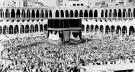
Leadership is recorded for her inside the Grand Mosque in Makkah and her fame spread the pilgrims from various regions of the Islamic world.

Figure 13. The Jumaimah square pond, feeding large circular water storage tanks automatically (Source)

Figure 14. Outlet to get water from a covered aqueduct bringing water to Makkah across mountains. (Source)
One of her substantial projects is the bringing of water to Makkah. She ordered in 194 AH / 809CE she constructed a pond, known as Birkat Um Jafar. She drew water from the springs of Hil. This was a very challenging task since the water had to cross the Makkah mountains. She succeeded in bringing water to her pond from springs of Al-Hal (such as the spring of Al-Mashash[134]), from which twelve miles long aqueducts were constructed feeding three ponds in Makkah.
She also dug a number of rainwater storage reservoirs. She also succeeded in bringing water from the springs of Honeen[135], which originated from a high mountain. and the water flows to Ha’it (fence) of Honeen, so she purchased the fence and constructed a pond, then utilized the wall to construct a dam in which the waters of torrents were gathered. Al-Azraqi[136] named those springs as: Ain Maymona, Ain Za’faran, Ain Al-Burood, Ain Al-Sarafa (al-Tarfi), Ain Al-Thuqba and Ain Al-Khiraibat. To sustainably maintain these works, Lady Zubayda established an endowment in the form of a few sizeable orchards whose annual income was estimated at thirty thousand dinars. In addition to all these water projects, she also ordered the creation of an aqueduct to bring water from the end of Wadi Al-Nu`man[137] to a place called Al-Awher; from there to Jabal Al-Rahmah then to Muzdalifa and from there to Mina, where it pours into a sizeable well called Bi’r Zubayda (Zubayda’s well)[138].

Figure 15. Aerial view showing directions of water in underwater channels from a Pond to storage tanks. Typical system all along the road from Iraq to Makkah. (Source)
It is stated that the chief manager of the works once told her that she had already spent almost four hundred thousand dirhams, and the work was still incomplete yet. Her reply was:
“Are you trying to dissuade me from completing this charity? Spend and complete the work even if it costs more than that”[139]
On completing the projects, the financial records were brought to her. To the astonishment of everyone, she took them by hand and threw them into the river and saying:
“The real accounts will be in the day of reckoning“[140]
It is worth noting that this road was not used only for Hajj, but rather for other uses, as it was a trade route linking the Levant and the Arabian Peninsula. It was also a military road taken by the Islamic Arab armies[141], in addition to students who go to Makkah to meet the scholars attending the Hajj season from all regions of the Islamic world. This is exemplified by Al-Maqeizi in his book Al-Thahab Al-Masbook:
“Whenever Caliph Harun al-Rashid performed Hajj, hundred jurists and their offspring would join him“[142]

Figure 16. A side of Zubaydah Water spring adjacent to Jabal Al-Rahmah, Makkah (Source)
The Zubayda road benefitted Iraqi pilgrims as well as those from the East of the Muslim world. The road was long and arid and had serve large numbers of pilgrims and other travellers.
Prior to Zubayda, Abbasid caliphs, their women and statesmen paid attention to pilgrims’ care and road maintenance. Lady Zubayda’s provisions to the pilgrimage road, the pilgrims and the Grand Mosque campus in Makkah far exceeded all, therefore history immortalized her by naming the most important pilgrimage roads in the Islamic world after her name.
It seems that naming the road after she came from the fact that her works on it, in terms of size and quality, were the last, so it remained as a landmark. More importantly, bringing water to the Grand Mosque in Makkah (Makkah water project) was substantial and unprecedented making her name and achievements popular amongst pilgrims and through them in the Islamic regions. Consequently, the Kufa-Makkah road became known as the Darb Zubayda.
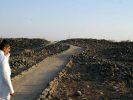
The road represents an important part of that era in Muslim civilization. Unfortunately, its archaeological features are now suffering from negligence and extinction. It is undoubtedly a worthwhile human monument and deserves the attention of the World Heritage organisation and the Gulf countries.
1- Ibn Al-Atheer, Izz Al-Din Abi Al-Hasan bin Muhammad bin Muhammad bin Abdul Karim bin Abdul Wahid Al-Shaybani Al-Jazri d. 630 AH. Al-Kamil fi Al-Tarikh (Comprehensive Study in History), ed. Abu Al-Fida Abdullah Al-Qadhi, Dar Al-Kutub Al-I’lmiya, Beirut, 1987
2- Al-Azraqi, Abu Al-Walid Muhammad bin Abdullah bin Ahmed d.250 AH. Akhbar Makkah Wa Ma Ja’a Min Al-Akhbar (Makkah News), ed. Rushdi Al-Salih Milhis, Madrid, 1385.
3- Al-Astakhri, Abu Ishaq/Isaac Ibrahim bin Muhammad Al-Karkhi 341 AH. Al-Masalik Wa Al-Mamalik (Pathways and Kingdoms), ed. Muhammad Jaber Abdil Al, Dar Al-Qalam Press, Cairo, 1961.
4- Ibn Battuta, Rihlat Ibn Battuta (Ibn Battuta’s Journey) called Tuhfat Al-Nuzzar Fi Ghara’ib Al-Amsar (an Eye-Catching Masterpiece in Oddity of Countries), ed. Ali Muntasir Al-Kittani, Al-Resala Foundation, Beirut, 1975.
5- Ibn Jubayr, Muhammad bin Ahmed d.614 AH. Rihlat Ibn Jubayr (Ibn Jubayr’s Journey), Beirut, 1964.
6- Al-Jaziri, Abdu Qadir Muhammad bin Abdul Qadir bin Muhammad bin Ibrahim Al-Ansari (d. 977 AH). Durar Al-Fawa’id Al-Munadhama Fi Akhbar Al-Hajj Wa Tareeq Makkah Al-Mu’adhama (the Precious Benefits in the News of Hajj and the Way to Glorified Makkah), The Salafi Press, Cairo, 1964.
7- Al-Harbi, Abu Ishaq/Isaac Ibrahim (b.285 AH). Al-Manasik Wa Amakin Turuq Al-Hajj Wa Ma’alim Al-Jazeera (the Rituals, the Hajj Sites of Pilgrimage Roads and landmarks of Jazeera), ed. Hamad Al-Jasir, Dar Al-Yamama, Riyadh, 1969.
8- Al-Himyari, Muhammad bin Abdul-Muni’m d.727 AH. Al-Rawd Al-Mi’tar fi Khabar Al-Amsa’r (the Odorous Garden in The News of Countries), ed. Ihsan Abbas, 2nd ed., Lebanon Library, 1984.
9- Ibn Khardathba, Abu Al-Qasim Ubayd Allah bin Abdullah d. 300 AH. Al-Masalik Wa Al-Mamalik (Pathways and Kingdoms), Muthanna Library, Baghdad, n.d. Al-Khateeb Al-Baghdadi, Abu Bakr Ahmed bin Ali d. 463 AH. Tareekh Baghdad Munthu Ta’sisiha Hatta Sanat 463 AH (History of Baghdad from its founding until the year 463 AH), the Salafi Library, Medina, n.d.
10- Ibn Khallikan, Abu Al-Abbas Shams Al-Din Ahmad bin Muhammad bin Abi Bakr d. 681 AH. Wafiyyat Al- A’yan Wa Anba’ Abna’ Al-Zaman (The Deaths of Notables and the News of the People of Time), Edited by Muhammad Mohi Al-Din Abdel-Hamid, The Egyptian Renaissance Library, Cairo, n.d.
11- Ibn Rustah, Abu Ali Ahmed bin Omar d. 290 AH. Al-A’laq Al-Hameeda, Brill Press, Leiden, 1891.
12- Al-Suyuti, Jalal Al-Din Abdul Rahman bin Abi Bakr d. 911 AH. Tareekh Al-Khulafa’ (the History of the caliphs, Edited by Muhammad Mohi Al-din Abdel Hamid, al Sa’ada Press, Egypt, 1959.
13- Al-Shabashti, Abu Al-Hasan Ali bin Muhammad d. 388 AH. Al-Diyarat, ed. Gorkis Aw’ad, Al-Muthanna Library, Baghdad, n.d.
14- Al-Tabari, Abu Jafar Muhammed bin Jarir (d. 310 AH). Ta’reekh Al-Rusul Wa Al-Mulook (History of the Apostles and Kings) known by Ta’reekh Al- Tabari (the History of Al-Tabari), ed. Muhammad Abu a-Fadhl Ibrahim, Dar Al-Ma’arif, Cairo, n.d.
15- Al-Fassi, Abu Al-Tayyib Taqi Al-Din Muhammad bin Ahmed bin Ali Al-Makki Al-Maliki d. 832 AH. Al-Aqd Al-Thameen Fi Tareekh Al-Balad Al-Ameen (the Precious Necklace in the History of the Trustworthy Country), Cairo, 1959.
16- Al-Fakihi, or Abdullah Muhammad bin Ishaq/Isaac d. 280 AH. Tareekh Makkah (published in Akhbar Makkah book), Khayyat Library, Beirut, n.d.
17- Ibn Al-Faqeeh, Abu Bakr Ahmad bin Ibrahim Al-Hamdhani d. 289 AH. Mukhtasar Al-Buldan (Abbreviation of Countries), Braille Press, Leiden, 1883.
18- Ibn Fahd Al-Makki, Muhammad bin Muhammad bin Omar Al-Qurashi Al-Hashimi d. 885 AH. Itha’f Al-Wara Bi Akhba’r Um Al-Qura, ed. Fahim Muhammad Shaltoot, Al-Khanchi Library, Cairo, 1983.
19- Ibn Qutayba, Abu Muhammad Abdullah bin Muslim Al-Dinuri d. 276 AH. Al-Imama Wa Al-Siyasa (the Imamate and Politics) known for Tareekh Al-Khulafa (the History of the Caliphs) attributed to him, ed. Taha Muhammad Al-Zayni, Arab Record Press, Cairo, 1967.
20- Qudama bin Jafar, Abu Al-Faraj bin Qudama bin Ziyad, Al-Kaatib Al-Baghdadi d. 337 AH. Al-Kharaaj Wa Sina’at Al-Kitaaba (the Agricultural Taxes and the Writing Skill), ed. Muhammad Hussein Al-Zubaydi, Dar Al-Rasheed, Baghdad, 1981
21- Ibn Kathir, Imad Al-Din Abi Al-Fida ‘Ismail Al-Qurashi d.774 AH. Al-Bidaya Wa Al-Nihaya (The Beginning and the End), Al-Sa’ada Press, Egypt, n.d.
22- Al-Maqdisi, Shams Al-Din Muhammad bin Ahmed d. 380 AH. Ahsan Al-Taqaseem Fi Ma’rifat Al-Aqaaleem (Best Shares of Knowledge of Territories, Leiden, 1906.
23- Al-Mawardi, Abu Al-Hasan Ali bin Muhammad bin Habib Al-Basri Al-Baghdadi d. 450 AH, Al-Ahkaam Al-Sultaniyya Wa Al-Wilayat Al-Diniyya (Royal Rulings and Religious Mandates), Freedom House for Printing, Baghdad, 1989.
24- Al-Maqrizi, Taqi Al-Din Ahmad bin Ali bin Abd Al-Qadir d.845 AH, Al-Thahb Al-Masbook Fimen Hajja Min Al-Mulook, Egypt, 1955.
25- Al-Sulook Li Ma’rifat Duwal Al-Mulook (the Path to Know the Countries of Kings), Cairo, 1956.
26- Yaqoot Al-Hamawi, Shihab Al-Din Abu Abdullah Yaqoot bin Abdullah Al-Rumi Al-Baghdadi d. 626 AH, Mu’jam Al-Buldan (the Lexicon of Countries), Dar Saadir, Beirut, 1955.
27- Al-Yaqoobi, Ahmed bin Abi Ya’qoob bin Wadhih (b. 292 AH). Tareekh Al-Ya’qoobi (the History of Al-Yaqoobi), ed. Muhammad Sadiq Bahr Al-Ulum, Al-Haidaryya Press, Najaf, 1974.
28- Hasan Ibrahim Hasan, Tareekh Al-Islam Al-Siyasi Wa Al-Dini Wa Al-Thaqaafi Wa Al-Ijtimaai (History of Political, Religious, Cultural and Social Islam, 7th ed. n.p.1964.
29- Khalid Azzam Hamad Al-Khalidi, Tandheemat Al-Hajj Wa Ta’theeratahu Fi Al-Jazeera Al-Arabia (the Influence of Hajj Organization on the Arabian Peninsula during the Abbasid era) 132-656 AH / 750-1258 CE, Riyadh, Saudi Arabia.
30- Sayyid Abdul Majid Bakr Al-Malaamih Al-Gografiyya Li Duroob Al-Hajeej, (Geographical Features of Pilgrims’ Paths), Jeddah, 1981.
31- Aarif Abdul-Ghani, Tareekh Al-Hira Fi Al-Jahiliyya Wa Al-Islam (the History of Hira in pre-Islam and Islam, Kinan House, Damascus, 1993.
32- Abd Al-Hussein Mahdi Al-Rahim, Al-Asr Al-Abbasi Al-Awwal – Al-Mu’ahilat Wa Al-Injazaat (The First Abbasid Era – Qualifications and Achievements), The Open University, Tripoli, 2002.
33- Abdul Sattar Al-Azzawi, Tareek Al-Hajj Al-Qadeem Wa Muhimmat Ihya’a (the Ancient Hajj Road and the Mission of its Revival), Center for the Revival of Arab Scientific Heritage, University of Baghdad, n.d.
34- Ali Abd Al-Rahman Al-Bahsin, Tareekh Makkah Fi Al-Asr Al-Abbasi (History of Makkah in the Abbasid Era), Prof. assistant, n.p.
35- Walter Hunts, Al-Makayeel Wa Al-aWzaan Al-Islamiyya Wa Ma yoa’diluha fi Al-Nidhaam Al-Matri (Islamic Bushels and Weights – their Equivalent in the Metric System), translated by Kamil Al-Asali, University of Jordan, Prof. assistant n.d.
36- Muhammad Al-Moa’llim, Al-Darb Al-Sultani – Tareek Al-Hajj Al-Berri Al-Iraqi Al-Qadeem (the Ancient Iraqi Overland Pilgrimage Road) called Darb Zubayda), House and Library of Knowledge Path and Dar Al-Adhwaa, Lebanon – Najaf.
37- Wijdan Fareeq Enad Al-Aridi, Imarat Al-Hajj Fi Al-Dawla Al-Arabia Al-Islamiyya (The Emirate of Hajj in the Arab Islamic State) 8- 132 AH / 629-750 CE, Amjad House for Distribution and Publishing, Amman, 2016.
38- Melik M M Al-Khayyat, Al-Sayyida Zubayda Wa Dawruha Al-Siyasi Wa Al-Umraani, (Lady Zubayda and her Political and Urban Role), College of Sharia and Islamic Studies – Historical and Civilizational Graduate Studies, Um Al-Qura University, Master Thesis, 1982
39- Nizar Aziz Habib Mahmood, Khadamaat Al-Hajeej Fi Al-Asr Al-Abbasy (Services of Pilgrims in the Abbasid Era) 132-334 AH, Unpublished Master Thesis, College of Arts – University of Basra, 1990.
40- Shahla Mamur Khashin Al-Azzawi, Zubayda Um Al-Amin, unpublished master thesis, Ibn Rushd College of Education – University of Baghdad, 2000.
41- Sulayman Abdul-Ghani Maliki, Tareek Rakb Al-Hajj Al-Iraqi Min Al-Kufa Ila Makkah Min Al-Fatih Al-Islami Hatta Suqoott Baghdad (Kufa- Makkah Iraqi Pilgrims Caravan Road from the Islamic Conquest until the Fall of Baghdad), Al-Dara Magazine, 2nd issue, Year 9, October 1983.
42- Wijdan Fareeq Enad Al-Aridi, Imarat Al-Hajj Fi Ahd Al-Khaleefa Abi Al-Abbas Al-Saffah (the Emirate of Hajj during the Reign of Caliph Abi Al-Abbas Al-Saffah), Majallat Al-Turath Al-Ilmi Al-Arabi (Arab Scientific Heritage Journal), 1st Issue, 2011.
43- https://www.alarabiya.net/ar/hajj/2013/10/04/
44- https://www.alukah.net/library/0/21642/
45- Darb Zubayda, Listed World Heritage Sites, https://whc.unesco.org/en/tentativelists/6025/
[1] Darb Zubayda (Pilgrim Road from Kufa to Makkah), https://whc.unesco.org/en/tentativelists/6025/
[2] Sa’ad Bin ‘Abd al-‘Aziz Rashid , “Medieval Routes to Mecca: A Study of the Darb Zubaidah Pilgrim Trail” , Peter Webb (Reviewer), Gilgamesh Publishing; None edition (June 1, 2020) 216 pages. Also:
al-Rashid, Saad A. and Young, M. J. L., “Darb Zubayda”, in: Encyclopaedia of Islam, Second Edition, <http://dx.doi.org/10.1163/1573-3912_islam_SIM_8460> First published online: 2012. First print edition: ISBN: 9789004161214, 1960-2007
[3] Al-Yaqoobi, Ahmed bin Abi Ya’qoob bin Wadhih (d. 292 AH). Tareekh Al-Yaqoubi (The History by Al-Yaqoobi), ed. Muhammad Sadiq Bahr Al-Uloum, Al-Haidarya Press, Najaf, 1974.
[4] Arif Abduk Ghani, Pre-Islamic and Islamic History of Al-Hira, Dar KananK Damascus 1993, p 269; Also Sayyed Abdul Majid Bakr, Geographical Features of Haj Roads, Jeddah, 1981, p 17
[5] Ibid p 18.
[6] Al-Tabari, Abu Jafar Muhammad bin Jarir 310 AH. The History of the Apostles and Kings, known as the History of Al-Tabari, ed. Muhammad Abu Al-Fadhl Ibrahim, Al-Ma’arif Publishing House, Cairo, 5/288.
[7] Omar bin Hubayra, Abu Muthanna Al-Fazari, the governor of Iraq of the Umayyads 128-132 AH. Ibn Khalkan, Abu Al-Abbas Shams Al-Din Ahmad ibn Muhammad d. 681 AH, Wafiyyat Al-A’yan Wa Anba’ Abna’ Al-Asr (Obituary of the Notables and the News of the Sons of the Time), ed. Ihssan Abbas, Dar Sader publishing house, Beirut, 1977 CE, 6/313.
[8] Al-Tabari, Tareekh (History), 6/116; Sulayman Abdul Ghani Maliki, Tareeq Rakb Al-Hajj Al-Iraqi Min Al-Kufa Ila Makkah Min Al-Fath Al-Islami Hatta Suqoot Baghdad (the Iraqi Caravan Pilgrim Road from Kufa to Makkah from the Islamic Conquest until the Fall of Baghdad), Al-Dara Magazine, 2nd edition, Year 9, October 1983, p. 14.
[9] Isa bin Musa bin Ali bin Abdullah bin Al-Abbas (the cousin of the three Caliphs Al-Saffah, Al-Mansur and Al-Mahdi. He is one of the Abbasid princes). See: Muhammad Al-Muallim, Al-Darb Al-Sultani (the Sultans’ Road) the Old Iraqi Overland Pilgrimage Road called Darb Zubayda, Tareeq Al-Ma’rifa and Dar Al-Adhwa’ Publishing House and Library, Lebanon – Najaf, p.42.
[10] Al-Tabari, Tareekh (History), 5/465; Ibn Al-Atheer, Izz Al-Din Abi Al-Hasan bin Muhammad bin Muhammad bin Abdul Karim bin Abdul Wahid Al-Shaybani Al-Jazri (d. 630 AH). Al-Kamil Fi Al-Tareekh (the Comprehensive History), ed. Abu Al-Fida Abdullah Al-Qadi, Dar Al-Kutub Al-‘Ilmiyya (The Scientific Books Publishing House), Beirut, 1987, 5/94; Wijdan Fareeq Enad Al-Aridi, Imarat Al-Hajj Fi Ahd Al-Khalifa Abi Al-Abbas Al-Saffah, Majallat Al-Turath Al-Ilmi Al-Arabi (Emirate of Hajj During the Reign of Caliph Abi Al-Abbas Al-Saffah, Arab Scientific Heritage Magazine), 1st Issue, 2011, P.33.
[11] Al-Qadisiyya, which is the first stage for those who were leaving Kufa to Hijaz. It contains palm orchards and riverbanks on Euphrates. It is supplied with fodder for camels targeting Hijaz Road, which is on the side of the Iraqi desert, where Al-Qadisiyya Battle took place under the leadership of Saad bin Abi Waqqas. Al-Tabari, Tareekh (History) 3/563; Al-Himyari, Muhammad bin Abdul-Moni’m d. 727 AH. Al-Rawdh Al-Moatar Fi Khabar Il Aqtar (the Odorous Grove in the Countries News), ed. Ihsan Abbas, 2nd ed., Lebanon Library, 1984, pp. 447-448; Sayyid Abdul Majeed Bakr, Al-Malamih Al-Gografia (Geographical Features), p. 36.
[12] Zabala, a city closer to Kufa where travelers rest. See: Al-Himyari, Al-Rawdh Al-Moattar (the Odorus Grove), p. 284.
[13] Abu Muslim al-Khurasani, Abd Al-Rahman bin Muslim al-Khurasani, one of the men of the Abbasid Islamic preachers in Khurasan. He became its ruler after the Abbasid’s success in power.
[14] Sulayman Abdul Ghani Maliki, Tareek Rakb Al-Hajj Al-Iraqi (the Iraqi Pilgrim Caravan Road), p. 14.
[15] Ibn Al-Atheer, Al-Kamil, 5/454; Ali Abd Al-Rahman Al-Bahsin, Tareekh Makkah Fi Al-Asr Al-Abbasi (History of Makkah in the Abbasid Era), p. 33.
[16] Al-Khuzaymiyya on the Iraqi Hajj Road, named after Khuzayma ibn Khazim. See: Melik M M al-Khayyat, Al-Sayyida Wa Dawruha al-Siyasi Wa Al-Umrani (Lady Zubayda and her Political and Urban Role), Um Al-Qura University, Master’s Thesis, 1982, p. 127.
[17] Ibid, p. 127.
[18] Al-Umq, an area of Beni Salim. It has a palace, a mosque, and many wells, the most famous of which is Al-Khadhra (the Green) of Abu Jafar al-Mansur, and the well of Al-Rawhaa (the Grove) for Baramika, currently part of Medina. See: Al-Harbi, Abu Ishaq (Isaac) Ibrahim (d. 285 AH). Al-Manaasik, Places of Pilgrimage Road and landmarks of Jazira, ed. Hamad Al-Jasir, Al-Yamama Publishing House, Riyadh, 1969, pp. 332-333; Melik M M Al-Khayyat, Al-Sayyida Zubayda, p. 145.
[19] Melik M. M. Al-Khayyat, Lady Zubayda, p. 145; Sulayman Abdul Ghani Maliki, Tareek Al-Haaj Al- Iraqi (Iraqi Caravan Hajj Road), p.15.
[20] The mail was an administrative system that transported messages between the capital of the Caliphate and other regions. The distance between one post station and another is 12 miles. See: Muhammad Ali Shaheen, Nidhaam Al-Bareed Fi Dhil Al-Khilafa Al- Abbasiyya (the Postal System in the Caliphate), see: https://www.alukah.net/library/0/21642/#ixzz6ZZDDLU6G
[21] Al-Suyuti, Jalal Al-Din Abdul Rahman bin Abi Bakr d. 911 AH. Tareekh Al-Khulafa’ (the History of the Caliphs), ed. Muhammad Muhyi Al-din Abdel Hamid, Al-Sa’ada Press, Egypt, 1959, pp. 272-273; Sulayman Abdul Ghani Maliki, Tareek Rakb Al-Hajj Al-Iraqi (Iraqi Caravan Hajj Road), p.15.
[22] Al-Ajfar, a location on the Iraqi Hajj Road, named so, for its big land holes and their wide basins, from which the road branches off to Al-Ushayra for those who do not want to go to Feed. In Pre-Islam, it was known as Al-Sarafa, located within Hayil region now. See: Melik M M al-Khayyat, Al-Sayyida Zubayda, pp. 128-129.
[23] Al-Maqrizi, Taqi Al-Din Ahmad bin Ali bin Abdul Qadir (d. 845 AH). Al-Sulook Li Maarifat Duwal Al-Mulook (A Guide to the Countries of Kings), Cairo, 1956, 1/15.
[24] Al-Marhala (Stage) equals twelve miles. A Post equals four Farsakhs. A Farsakh equals three Hashemite miles or two and a half miles in Umayyads miles. See: Melik M M Al-Khayyat, Al-Sayyida Zubayda, foot note 2, p. 113; Ali Abdul Rahman Al-Bahsin, Tareekh Makkah (History of Makkah), p. 368.
[25] Sulayman Abd Al-Ghani Maliki, Tareek Rakb Al-Hajj Al-Iraqi (the Iraqi Caravan Hajj Road), P. 17.
[26] Ibid, p. 17.
[27] Ibid, p. 17.
[28] Ibid, p. 17.
[29] Among the names mentioned by historical sources undertook that mission, Yaqtin bin Musa and his brother Abu Musa, Jafar bin Sulayman bin Ali, Muhammad bin Sulayman, and Muhammad bin Abdullah Al-Asadi. See: Sayyid Abdul Majeed Bakr, Al-Malaamih Al-Gografiyya (the Geographical Features), pp. 19-20.
[30] Ali Abdul Rahman Al-Bahsin, Tareekh Makkah (History of Makkah), p. 59.
[31] What is meant here is the mandate to run the pilgrims, and whoever wields it would be the commander in charge of the pilgrims’ caravan from its departure until it reaches Makkah and takes it back home. Al-Mawardi, Abu Al-Hasan Ali bin Muhammad bin Habib Al-Basri Al-Baghdadi d. 450 AH. Al-Ahkam Al-Sultaniyya Wa Al-Wilayat Al-Diniyya (Royal Provisions and Religious Mandates), Dar al_Hurriyya (Freedom House) for Printing, Baghdad 1989, p. 171; Wijdan Fareeq Enad Al-Aridi, Emarat Al-Hajj Fi Al-Dawla Al-Arabia Al-Islamiyya (the Emirate of Hajj in the Arab Islamic State) 8- 132 AH / 629-750 CE, Dar Majd, Jordan, 2016, pp. 47-57.
[32] Ali Abdul Rahman Al-Bahsin, Tareekh Makkah (History of Makkah), P. 366-367.
[33] Al-Harbi, Al-Manasik (the Rituals), p. 286.
[34] Al-Khayzaran’s Jaria (maid), a famous philanthropist female figure in the Abbasid era. See: Al-Harbi, Al-Manasik (the Rituals), pp 282-285; Muhammed Al-Muallim, Al-Darb Al-Sultani (the Sultans’ Road), pp. 44-45.
[35] Al-Harbi, Al-Manasik (the Rituals), p. 301; Sa’yyid Abdil Majeed Bakr, Al-Malamih Al-Goghrafiyya (the Geographical Features), p. 19.
[36] Al-Harbi, Al-Manasik (the Rituals), p. 305.
[37] Ibid. p. 282.
[38] Battan is a place on the Iraqi Hajj road. It has a number of ponds and a palace. It belongs to Beni Asad. See: Melik M M Al-Khayyat, Al-Sayyida ( Lady .) Zubayda), p. 124.
[39] Sulayman Abdul-Ghani Maliki, Tareeq Rekb Al-Haj Al-Iraqi (Iraqi Pilgrim Caravan Road), p. 124.
[40] Ibid, p. 125.
[41] See: Al-Zubaydiyyat: Al-Harbi, Al-Manasik (the Rituals), pp. 281-356.
[42] Al-Magheetha means the land where rain falls on. It is one of the areas of the Iraqi Hajj Road. It is different from Magheethat Al-Mawan. There are ponds for collecting rainwater in Al-Magheetha. See: Yaqoot, Shihab Al-Din Abu Abdullah Yaqoot bin Abdullah Al-Rumi Al-Baghdadi d. 626 AH, Mu’jam Al-Buldan (Lexicon of Countries), Dar Saadir, Beirut, 1955, 5/450; Melik M M Al-Khayyat, Sayyida (Lady .) Zubayda, pp. 117, 138.
[43] Al-Uthayb, an area on the outskirts of Kufa, near of which Ayn (spring) Al-Sayyid is located. It is part of Badiyat Al-Iraq. See: Al-Rawdh Al-Mitar (the Odorous Grove), p. 409; Sayyid Abdul Majeed Bakr, Al-Malamih Al-Gographiyya (Geographical Features), p. 36. See: Appendix No. 1.
[44] Al-Qara’ is located on the Iraqi Hajj road, so called because of the lack of plants. There are a number of wells there. Melik M M Al-Khayyat, Al-Sayyida (Lady) Zubayda, p. 117.
[45] Al-Haytham means the red sand, which is a place on the Iraqi Hajj road. Sees: – Ibid., Pp. 119-120.
[46] Al-Qa’, a flat area. It is one of the most fortified areas. It has a number of ponds. See: Ibid., P. 119.
[47] Al-Rustumiyya is a dinner place on the road of the Iraqi Hajj, six miles away from Al- Shuqooq area on the right. It has a palace and a group of ponds. Ibid., P. 123
[48] Al-Shuqooq (the cracks) is an area on the road of the Iraqi Hajj caravan. Its name came from the plural of Shaq (crack). It belongs to Beni Asad. It contains a number of ponds. See: Ibid, p. 122.
[49] Qabr Al-Abadi (the Abadi’s Tomb), one of the areas through which the Iraqi Hajj Caravan used to pass. It is named after a Christian man who embraced Islam and died there. See: Ibid. 125.
[50] Al-Tha`labiyya, a region on the Iraqi Caravan Hajj Road, a walled city with baths, a market, and a gathering Mosque. It belonged to Beni Asad then. It is said that it arose during the reign of the Umayyad Caliph Abd Al-Melik bin Marwan. Today it is called Al-Tha’labi and it belongs to Medina. See: Ibid pp. 125-126.
[51] Toz is one of the areas through which the Iraqi pilgrimage caravan passes overland. It has a number of wells. See: Qudama bin Jafar, Abu Al-Faraj bin Qudama bin Ziyad Al-Katib Al-Baghdadi d. 337 AH. Al-Kharaj Wa Sina’at Al-Kitaba (the Agricultural Income and the Writing Art), ed. Muhammad Hussain Al-Zubaydi, Dar Al-Rasheed, Baghdad, 1981, p. 189.
[52] Sumayra is a house on the road to Makkah, it was said that it was named so because the surrounding hills were dark in color, See: Melik M M Al-Khayyat, Al-Sayyida (Lady) Zubayda, p. 133.
[53] Qurura, a name of a mountain that overlooks the dinner place and has a flag. It has two Ponds and a well-known location until the present time. See: Ibid, p. 135.
[54] Al-H’ajir, a name obtained either from the name of a rich man, or from the H’ajir (stone-blocker) which holds water from the valley side. See: Ibid., p. 134.
[55] Al-Nuqra is called Ma’dan Al-Nuqra or Ma’dan Al-Qarashi. It is named after the man who excavated it, Nuq ibn Janada. It had eight flags, two for entran CE, two for exit, two for Basra Road, and two for Medina Road from that the road diverges, so whoever wants Medina turns left where Asayla is, and whoever wants Makkah turns to the right to Mawan where Magheethat Al- Mawan is. See: Ibid, p. 136.
[56] Yaqoot, Mu’jam Al-Buldan (the Lexicon of Countries), 4/325.
[57] Abdul Sattar Al-Azzawi, Tareeq Al-Hajj Al-qadeem Wa Muhimmat Ihya’ih (The Old Hajj Road and the Mission for its Revival), Center for the Revival of the Arab Scientific Heritage, University of Baghdad n.d., p. 8 – footnote 6.
[58] See: Al-I’tida Ala Al-Hijjaj Wa Ala Tareeq Al-Hajj Al-Barri (the Assault on the Pilgrims and on the Road to Hajj overland) (Darb Zubayda) by Sahib Al- Zinj, Al- Qaramita and the Bedouins: Ibn Al-Atheer, Tareekh (History), 8/313; Sulayman Abdul Ghani Maliki, Tareeq Al-Hajj Al-Iraqi (the Iraqi Hajj Caravan Road), pp. 21-24; Muhammad Al-Muallim, Al-Darb Al-Sultani (the Sultans’ Road), pp. 49-63.
[59] Sulayman Abdul Ghani Maliki, Tareeq Rakb Al-Hajj Al-Iraqi (the Iraqi Pilgrim Caravan Road), page 17, page 2.
[60] Al-Maqrizi, Taqi Al-Din Ahmad bin Ali bin Abd Al-Qadir 845 AH, Al- Thahab Al-Masbook Feeman Hajj Min Al-Mulook, Egypt, 1955, p. 62, 81, 84.
[61] Al-Khateeb Al-Baghdadi, Tareekh Baghdad Munthu Ta’sisiha Hatta Sanat 436 AH (History of Baghdad since Establishment till 436 AH), Salafi Library, Medina, n.d. 14/433; Ibn Kuthayr, Imad Al-Din Abi Al-Fida Ismael Al-Qarashi d. 774 AH, Al-Bidaya wa Al-Nihaya (th Beginning and the End), Al-Sa’ada Press, Egypt n.d. 10/271. There are other names for Lady Zubayda, See; Shahla Mamur Khashin, Zubayda Um (mother of) Al- Ameen, M.A thesis, unpublished, Ibn Rushd College of Education-Baghdad University, 2000 pp 7/8.
[62] Look for her Parentage: Ibn Khalkan, Wafiat Al-A’ayan (the Obituary of the Notables), 2/70.
[63] Al-Khateeb Al-Baghdadi, Tareekh Baghdad, 14/433.
[64] Al-Tabari, Tareekh (History), 8/359; Al-Shabishti, Abu Al-Hasan Ali bin Muhammad d. 388 AH. Al-Diyarat, ed. Gorkis Awad, Al-Muthanna Library, Baghdad, n.d. p. 157.
[65] Al-Yaqoobi, Tareekh Al-Yaqoobi, 1974, 3/206; Al-Tabari, Tareekh (History), 8/359; Ibn Al-Atheer, Al-Kamil (a Comprehensive History), 5/496.
[66] Al-Azraqi, Abu Al-Waleed Muhammad bin Abdullah bin Ahmed d. 250 AH. Akhbar Makkah wa ma ja’a Fiha Min Al-Aathaar (Makkah News and Impacts), ed. Rushdi Al-Saleh Milhis, Madrid, 1385 AH, 2/230.
[67] Ibid, 2/230.
[68] Al-Tabari, Tareekh (History) 8/254.
[69] Ibn Qutayba, Abu Muhammad Abdullah bin Muslim Al-Dinuri d. 276 AH. Al-Imama Wa Al- Siyasa (the Imamate and Politics) known as Tareekh Al- Khulafaa (History of Caliphs) which is attributed to him, ed. Taha Muhammad Al-Zayni’s, Sijil Al-Arab (Arab Record) Press, Cairo, 1967, 2 / 192-193.
[70] Lady Zubayda and her husband, Caliph Al-Rashid, were not the first to perform Hajj on foot. In fact, it was a custom that existed among the poor Muslims, and whoever was able to participate with others in kind of a group of not less than ten, hiring a camel to carry their belongings only, while the pilgrimage on foot for the rich is motivated by veneration for Makkah in the hope of increasing the reward from God Almighty, see: Khalid Azzam Hamad Al-Khalidi, Tandhimaat Al-Hajj Wa Ta’theeratiha Fi Al-Jazeera Al-Arabiya Khila Al-Asr Al-Abbasi (the Influence of Hajj Organization on the Arabian Peninsula during the Abbasid Era) 132-656 AH / 750-1258 CE, Riyadh, Saudi Arabia, 2006, p. 124;
https://www.alarabiya.net/ar/hajj/2013/10/04/
Perhaps most of the pilgrims who performed Hajj with the caliph and his wife in that year made the pilgrimage on foot as well. The caravan might have departed in that year in advance of its due date in order to have sufficient time to reach the Holy Land.
[71] Al-Azraqi, Akhbar Makkah (Makkah News), 2/379.
[72] Hasan Ibrahim Hasan, Tareekh Al-Islam Al-Siyasi Wal Deeni Wal Thaqafi Wal Ijtima’I (History of Political, Religious, Cultural and Social Islam), 7th Edition, n.d. 1964, 2/431
[73] Al-Yaqobi, Tareekh (History), 3/171.
[74] Ibid, 3/176.
[75] Ibn Fahd Al-Makki, Muhammad bin Muhammad bin Omar Al-Qurashi Al-Hashimi d. 885 AH. Ithaf Al Wara Bi Akhbar Um Il Qura (The Inspiration of Wars with Um Al-Qura News), ed. Fahim Muhammad Shaltoot, Al-Khanji Library, Cairo, 1983, 2/283.
[76] Al-Fakihi, Abu Abdullah Muhammad bin Ishac/Isaac 280 AH. Tareekh Makkah (the History of Makkah) published within the book Akhbar Makkah Al-Musharrafa “the Glorified Makkah News”), Khayyat Library, Beirut, p. 34; Ibn Fahad Al-Makki, Ithaf Al-Wara, 2/285.
[77] Nizar Aziz Habib Mahmoud, Services of Pilgrims in the Abbasid Era 132-334 AH, Unpublished Master Thesis, College of Arts – University of Basra, 1990, pp. 172-173.
[78] A village two miles away from Baghdad, with a road connected to orchards. It is located on the Isa River, which takes water from Euphrates to pour into Tigris near Baghdad. Al-Harbi, Al-Manasik (the Rituals), p. 816; Yaqoot, Mu’jam Al-Buldan (the Lexicon of Countries), 5/425; Nizar Aziz Habib Mahmoud, Khadamaat Al-Hajeej (the Pilgrims Services), pp. 172-173
[79] Al-Harbi, Al-Manasik (the Rituals), pp. 173-174.
[80] A village two Farsakhs far from Baghdad; Farsakh is (4-6 miles). See: Yaqoot, Mu’jam Al-Buldan (the Lexicon of Countries), 3/401.
[81] A village two miles away from Baghdad in the green side of Iraq that pilgrims visit. See: Yaqoot, Mu’jam Al-Buldan (the Lexicon of Countries) 4/243, Khalid Azzam Hamad Al-Khalidi, Tandeemat Al-Hajj (the Hajj Organization), p. 138, footnote 4.
[82] A city near Hilla. See: Yaqoot, Mu’jam Al-Buldan (the Lexicon of Countries), 3/278; Khalid Azzam Hamad Al-Khalidi, Tandeemat Al-Hajj (Hajj Organization), p. 138, footnote 1.
[83] Ibn Rustah, Abu Ali Ahmed bin Omar d. 290 AH. the Precious Origins), Brill Press, Leiden, 1891, p. 174.
[84] Al-Jaziri, Abdul Qadir Muhammad bin Abdul Qadir bin Muhammad bin Ibrahim Al-Ansari 977 AH. Durer Al- Fawa’id Al-Munadhama Fi Akhbar Wa Tareeq Makkah Al-Mukarrama (Preciousness of Organized Benefits in Al-Hajj News and the Way to Makkah), the Salafi Press, Cairo, 1964, p. 465; Ali Abdul Rahman Al-Bahsin, Tareekh Makkah (History of Makkah), p. 373.
[85] Al-Malamih Al-Gografiyya (the Geographical Features), p. 22.
[86] Ibid, p. 23.
[87] Al-Jaziri, Durar Al-Fawa’id (the Precious Benefits), p. 465.
[88] Sayyid Abdul Majeed Bakr, Al-Malamih Al-Gografiyya, pg. 26
[89] The remains of the road stations within the borders of Iraq currently are: Khan Al-Rahba, Birkat Zubayda, Mantaqat Al-Hammam, Um Al-Quroon Minaret, Bir Al-Nuss, Mahattat Mugheetha, Birkat Hamad, Birkat Al-Hamam, Birkat Al-Masjid, Mahattat Al-Eid, Mahattat Al-Sijer, Mahattat Ashraf, Mahattat Waqisa , Birkat Al-Amaya, Mahattat Al-Dhafi. See: Abd Al-Sattar Al-Azzawi, Tareek Al-Hajj Al-Qadeem (The Old Hajj Road), pg. 1-2.
[90] Ibid, p. 2.
[91] A part of Iraqi territory close to the border with the Kingdom of Saudi Arabia, the road meets next to the border between Iraq and Saudi Arabia, approximately at latitude 22-30 north and longitude 39-43 east. See: Sayyid Abdul Majeed Bakr, Al-Malamih Al-gografiyya (the Geographical Features), 38. See: annex 1.
[92] Ibn Rustah, Al-A’laq Al-Nafisa, p. 175.
[93] Al-Tananeer, which is a dinner pla CE, where the road branches out into a road called Lina. See: Melik M M Al-Khayyat, Lady Zubayda, p. 122.
[94] Feed is a city in the middle of the road between Baghdad and Makkah. Its people belong to Tay tribe. See: Al-Himyari, Al-Rawd Al-Moattar (the Odorous Grove), p. 443.
[95] Mugheetha Al-Mawn, differs from Al-Mugheetha. It is located between Al-Uthayb and Al-Qa’. It is called today Al-Umayra, See: Yaqoot, Mu’jam Al-Buldan (the Lexicon of Counries), 5/450, Melik M M Al-Khayyat, Sayyida Zubayda, p. 138.
[96] Today it is called Birkat Abu Saleem. It is 250 km from Medina. See: Muhammad Al-Mu’allim, Al-Darb Al-Sultani (the Sultans’ Road), p. 25, footnote 3.
[97] So said, it was named after Al-Saleel bin Zayd bin Al-Harith bin Thakwan of Beni Saleem, who master planned it. It includes a pala CE, a mosque, a number of wells, and a square pond with a refinery. It belongs to Emirate Al-Ula. See: Al-Harbi, Al-Manasik (the Rituals), p. 553; Melik M M Al-Khayyat, Al-Sayyida (Lady ) Zubayda, p. 144.
[98] Ma’den Beni Saleem: a place called Mahd Al-Thahab (the Cradle of Gold), due to the existence of gold in, See: Al-Harbi, Al-Manasik (the Rituals), p. 332; Melik M M Al-Khayyat, Lady Zubayda, p. 146.
[99] Afi’iyya, so called because of the many thousands of snakes in. It has a round pond with a refinery called Harar and a number of large wells. See: Qudama bin Jafar, Al-Kharaj (the agricultural revenue), 186; Melik p. 154.
[100] Al-Maslah is called so because it is a location of weapon for the armed forces. The Caliph Abu Jafar Al-Mansur diverted the road to it after he was passing through Ba’th, so he dwelt in the village. It includes a pala CE, a mosque, a square pond, a refinery, a pond for Masroor Al-Khadim and a number of wells too. See: Yaqoot, Mu`jam Al-Buldan (the Lexicon of Countries) 5 / 128-129, Melik M M Al-Khayyat, Al-Sayyida ( Lady .) Zubayda, p. 155
[101] Ghumra, so called because it contains a large quantity of water. See: Ibn Rustah, Al-Alaq Al-Nafisa, p. 179; Melik M M Al-Khayyat, Al-Sayyida (Lady) Zubayda, p. 158.
[102] That-Irq, a large house with trees, water and ponds. It is the Hajj due for the people of Iraq. See: Al-Himyari, Al-Rawd Al-Moattar (the Odorous Grove), p. 256.
[103] See: Al-Harbi, Al-Manasik (the Rituals), pp. 281-283. I relied on Al-Harbi (being the oldest) in the order of regions and the distance between each. For comparison with other sources, I adopted some of the most important sources and put them in the appendix for comparison with other sources; Ibn Khardathbeh, Abu Al-Qasim Ubaydullah bin Abdullah d. 300 AH. Al-Masalik Wa Al-Mamalik (Pathways and Kingdoms), Muthanna Library, Baghdad, p. 126; Qudama bin Jafar, Al-Kharaj (the agricultural Revenue), pp. 77-80; Al-Maqdisi, Shams Al-Din Muhammad bin Ahmed d. 380 AH. Ahsan Al-Taqaseem Fi Ma’rifat Al-Aqaleem (best Shares in Knowledge of Territories), Leiden, 1906, pp. 253-254. See: Appendix 2.
[104] Khalid Azzam Hamad Al-Khalidi, Tandheemat Al-Hajj (Hajj Organization), P.137.
[105] Ibn Al-Faqeeh, Abu Bakr Ahmed bin Ibrahim Al-Hamadhani d. 289 AH. Mukhtasar Kitab Al-Buldan (an Abstract Book of Countries), Braille Press, Leiden, 1883, p. 22.
[106] Al-Istakhri, Abu Ishaq /Isaac Ibrahim bin Muhammad Al-Karkhi 341 AH. Al-Masalik Wa Al-Mamalik (Paths and Kingdoms), ed. Muhammad Jaber Abdel-A’l, Dar Al-Qalam Press, Cairo, 1961, p. 28. Al-Marhala (the Stage) is equal to eight Farsakhs. A Farsakh is equal to 6km. A mile equals 2km. See: Walter Hunts, the Islamic Scales, Weights and their Equivalents in the Metric System, translated from German by Kamil Al-Asali, University of Jordan, n.d. p.94-95.
[107] Al-Jaziri, Durar Al-Fawayid (the Precious Benefits), p. 442.
[108] Al-Muta’asha is the place where travelers and pilgrims stay at dinner time.
[109] Al-Harbi, Al-Manasik (the Rituals), pp. 290-239.
[110] Ibn Al-Faqeeh, Mukhtasar (SOmary), p. 22.
[111] Ibid, page 22
[112] Al-Harbi, Al-Manasik (the Rituals), p. 320; Nizar Aziz Habib, Khadamat Al-Hajeej (Pilgrims’ Services), p. 85.
[113] Ibn Jubayr, Muhammad bin Ahmed d. 614 AH. Rihlat Ibn Jubayr (Ibn Jubayr’s Journey), Beirut, 1964, p. 185.
[114] Ibn Battuta, Rihlat Ibn Battuta (the Journey of ibn Battut), also known as Tuhfat Al-Nuzzar Fi Ghara’ib Al- Amsar Wa Aja’ib Al-Asfa’r (the Masterpiece of the Viewers of Countries’ Oddities and the Wonders of Travel), ed. Ali Muntasir Al-Kattani, Risala Foundation, Beirut, 1975, 2 / 190-191.
[115] Abd Al-Sattar Al-Azzawi, Turuq Al-Hajj Al-Qadeem (Ancient Hajj Roads), pp. 2-6.
[116] We mentioned only what is in the main stations and what is between them from Kufa to Makkah; also we disregarded the secondary roads that branch off the main road, which they would shorten time and distan CE, or that would go to Medina before Makkah, so Al-Mansur established a stone paved secondary road between Haza and Safina, including the secondary road between Medina and Rabatha, which was constructed by Caliph Al-Rasheed, then Ali bin Isa took care of the secondary road that passes through Al-Maslah, avoiding lengthening. The researcher can go back to the sources to see parallel services to that available in the main road.
[117] See: Al-Harbi, Al-Manasik (the Rituals), pp. 281-282; Melik M M Al-Khayyat, Al-Sayyida (Lady) Zubayda, pp. 116-120.
[118] Al-Harbi, Al-Manasik (the Rituals); Yaqoot, Mu’jam Al-Buldaan (the Lexicon of Countries) 3/356; Melik M M Al-Khayyat, Al-Sayyida (Lady) Zubayda, pp. 120-124.
[119] Al-Harbi, Al-Manasik, pp. 291-293.
[120] Al-Harbi, Al-Manasik (the Rituals), p. 298 – and beyond; Melik M M Al-Khayyat, Lady Zubayda, pp. 125-131.
[121] Ibn Khardathba, Al-Masalik Wa Al-Mamalek, (Paths and Kingdoms) p. 137.
[122] Al-Harbi, Al-Manasik (the Rituals), p. 300 – and beyond; Ibn Rustah Al- A’laq Al-Nafisa p. 176 Melik M M Al-Khayyat, Al- Sayyida (Lady) Zubayda, pp. 132-135.
[123] Al-Harbi, Al-Manasik (the Rituals), pp. 323-325; Melik M M Al-Khayyat, Al-Sayyida (Lady) Zubayda, pp. 136-138.
[124] Al-Harbi, Al-Manasik, pp. 325, 551-552; Yaqoot, Mu’jam Al-Buldan (the Lexicon of Countries) p. 2/144; Melik M M Al-Khayyat, Lady Zubayda, pp. 135-139.
[125] Al-Harbi, Al-Manasik, pp. 323-326.
[126] Melik M M Al-Khayyat, Lady Zubeida, pp. 139-154.
[127] Al-Harbi, Al-Manasik, pp. 346-353; Melik M M Al-Khayyat, Lady Zubaydah, pp. 154-163.
[128] Al-Harbi, Al-Manasik (the Rituals), p. 354.
[129] Melik M M Al-Khayyat, Sayyida (Lady) Zubaydah, pp. 164-170.
[130] Shahla Mamur Khashin Al-Azzawi, Zubayda Um Al-Amin, p. 121.
[131] Melik M M Al-Khayyat, Al-Sayyida (Lady) Zubayda, p. 194.
[132] Ibid, p. 194.
[133] Ibid, p. 195.
[134] Ain Al-Mashash, a spring of water found in the area where Mount Arafa is connected to the Ta’if Mountains, an area described as having large amounts of water. See: Yaqoot, Mu’jam Al-Buldan (the Lexicon of Countries) 5/131; Shahla Mamur Khashin Al-Azzawi, Zubayda Um Al-min, p. 101
[135] Hunayn, a valley near Al-Ta’if. Al-Humayri, the distance estimated as few miles away from Makkah. See: Al-Rawd Al-Mu’attar (the Aromatic Grove), p. 202.
[136] See: Akhbar Makkah (Makkah News), 2/231, Shahla Mamur Khashin Al-Azzawi, Zubayda Um Al-Amin, pp. 102-101.
[137] A valley near Makkah. See: Shahla Ma’mur Khashin Al-Azzawi, Zubayda Um Al-Amin, p. 103, margin 2.
[138] Shahla Mamur Khashin Al-Azzawi, Zubayda Um Al-Amin, pp. 102-101.
[139] Al-Fassi, Abu Al-Tayyib Taqi Al-Din Muhammad bin Ahmad bin Ali Al-Makki Al-Maliki d. 832 AH. Al-Iqd Al-Thameen Fi Tareekh Al-Balad Al-Ameen (The Precious Necklace in the History of the Trustworthy Country, Cairo, 1959, 8/237.
[140] Ibid, 8/237.
[141] Abd Al-Sattar Al-Azzawi, Tareek Al-Hajj Al-Qadeem (the Ancient Hajj Road), p. 2.
[142] Al-Maqrizi, p. 117.
Discover the golden
age of Muslim civilisation.
© Copyright FSTC Ltd 2002-2020. All Rights Reserved.