This article explores the historic Levantine hajj route to Makkah by studying various historical-geographical sources that describe the stations on the route. A map is provided of the historical route. The author’s research seeks to address the trend amongst revisionist historians of Islam who have posited an alternative location to the Ka’bah in Makkah, the sacred site of pilgrimage for Muslims. This article is a translation of the author’s original paper in Arabic. The significance of this study lies in the fact that its subject is the Levantine route to Makkah, with the primary objective being to research amidst historical and geographical sources the description of these stations so as to find answers to the question of: Is there any indication in such sources as to an alternative location of the sacred Ka’bah in contrast to its current location in Makkah?

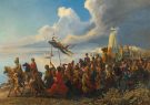
Figure 1. The Hajj by Alfred Dehodencq – Public Domain
***
Scholars within Muslim civilization produced a substantial amount of work in various scientific fields, including geographical studies. Such studies are characterized by extensive historical content, the beauty of delivery and detailed descriptions of places with high methodological standards in classification and organization. Through these, the authors touch upon events that happened prior to their time, making their work a manifestation of the advanced level that civilization had reached.
It would not be justified for researchers to exclude these sources when they find that the material is contrary to their own opinions; however, a trend in scholarship seems to have gained ground, adopting a sceptical line of research which seeks to cast doubt on the original location of the Ka’bah of Prophet Ibrahim. This approach is far from the scientific rules of the historical research method.
It is for this reason that we have decided to write on the topic of (the Levantine hajj route and the ruins of the people of Lut – A study of the Islamic geographical sources), among the reasons which led to choosing this title is that it falls within the area of our current and past interest in pursuing the hajj and trade routes. This research is made easy due to the fact that the author is familiar and well-versed with the historical geographical sources that identify the ‘service’ stations of those routes and describe their features. They also give distances with great accuracy which reflects their experience and knowledge of the history and geography of such routes.
The significance of this study lies in the fact that its subject is the Levantine route to Makkah, with the primary objective being to research amidst historical and geographical sources the description of these stations so as to find answers to the question of: Is there any indication in such sources as to an alternative location of the sacred Ka’bah in contrast to its current location in Makkah?
The problem of the study: A trend has emerged in some revisionist historical research groups which casts doubt on the original location of Makkah. One of these claims is based on the Quranic verses (133-138) of chapter Al-Saffat: “And indeed Lut was among the messengers (133) (Mention) when We saved him and his family, all (134) Except his wife among those who remained (with the evildoers) (135) Then we destroyed the others (136) And indeed, you pass by them in the morning (137) And at night. Then will you not reason? (138)”
The movement was spearheaded largely by the revisionist historian Patricia Crone. See, for example, Patricia Crone, Meccan Trade and the Rise of Islam, Princeton: Princeton University Press, 1987, 163. See also her book ‘What do we actually know about Mohammed?’, Open Democracy, 10 June 2008
The ruins that are referred to in this verse are the destroyed cities of Sodom and Gomorrah which are located in the Dead Sea, which lies in the Jordan Rift Valley. The argument is that for the people of Makkah to observe these ruins during the morning and the evening during their travels, they would have to be very close to them.
We shall discuss this issue relying on historical research methodology in surveying the knowledge corpus from historical sources through gathering, analyzing and deducing.
This study rests on the hypothesis that there is insufficient evidence that support the suggestion that the Ka’bah was originally located at a different place.
This study is confined to the Levantine hajj route that links the Levant and Makkah from pre-Islamic times until the Umayyad caliphate.

Figure 2. The Hajj caravan. Maqamat of al-Hariri, written and illustrated by Yahya al-Wasiti, Iraq 1237. The mahmal is yellow, the Mamluk dynastic colour (© Bibliothèque Nationale, Paris)[The most iconic of the artworks associated with the Hajj are the textiles offered to the Ka’abah that are carried in the Mahamal. These comprised a number of different elements, including an overall covering (kiswah), a belt (hizam), the door curtain (sitarah) and the interior textiles.]
1 – Dradkeh, Saleh Musa. The Levantine Hajj Route in the Umayyad Era, 4th international conference on the history of the Levant (The Levant in the Umayyad era), (Amman, 1996).
2 – Musel, A. Shamal Al-Hijaz, translated by Abdul Muhsin Al-Husaini (Alexandria, 1952).
3 – There are other publications in the English language that have discussed the Damascus hajj route such as: Claudine Dauphin, Mohamed Ben Jeddou & Jean-Marie Castex, Mecca on Pilgrimage on Foot and Camel-back: The Jordanian Darb al-Hajj, Bulletin of the Council for British Research in the Levant, Vol 10, Issue 1 , Pages 23-36 | Published online 22 Dec 2015
We noticed a few errors in this article, such as the mention of the renowned medieval traveller Ibn Battuta as the earliest to record the names of the stations on the route. Ibn Battuta, who died in 779 AH/1377 CE, which is much later than the sources we used.
The study is composed of:
– Introduction
– The route’s history and its historical importance at a glance
– The stations of the Levantine hajj route which extends from Damascus to Madinah.
– The last leg of the Levantine hajj route at which the convoys complete their journey from Madinah to Makkah.
– A look at the Arab-Islamic geographical sources.
– Conclusion
– An appendix which contains a list of the stations on the Levantine hajj route with their sources.

Figure 3. The route of Hejaz Railway – GNU Free Doc. Lic.
The subject of the routes of hajj is among the important topics in historical studies, given that it relates to the path taken by Muslims to perform the religious duty of hajj, and its importance is evident by the attention that caliphs of various historical time periods gave to the hajj routes and their stations.
This study is limited to the hajj route from Damascus to Makkah which is known as the Levantine hajj route, indicating the main stations along the route.
The leader of the hajj caravan during the era of the Umayyad caliphate would normally be nominated by the caliph. In most occasions, it would be the governor of the Hijaz, although in some years the leader of the hajj caravan would be either the caliph himself, his heir, or a member of the royal family. The leader of the hajj season would set off from Damascus towards Makkah and traverse across the stations of the Levantine route; effectively making it the official route for the hajj caravan.
The history of the route connecting the Levant and the Hijaz goes back to pre-Islamic times, for the links between the two regions were not broken during the successive historical eras, but rather increased and developed due to their geographical connectedness, as this region had a prominent role in international transportation since the earliest historical periods, and due to the existence of mutual interests between them which was manifested in their intermediary role in international trade.
The link between the Levant and Makkah was very strong since before Islam, for the Quraishite merchants had become very familiar with the Levant. The effect of this connection continued after the advent of Islam, for the route towards the Levant was well known which facilitated the movement of the Arab Muslim army towards it for its liberation. Additionally, the advent of Islam added another connection between Makkah and the Levant, which may be considered one of the most important of all the links – the Hajj pilgrimage. The region of the Hijaz includes the two holiest cities for Muslims, which are Makkah and Madinah. Pilgrimage to Makkah is one of the pillars of Islam, and this factor necessitated the development of transport links. As a result, the Muslim caliphs were involved in taking care of the hajj routes, beginning with the digging of wells and the construction of bridges, and the placing of signs.
It must be pointed out that the sources mention names of the routes that link Makkah and the Levant. These are Al-Tariq al-Mu’tadilah (the moderate route) and Tariq al-Ma’rifah (the coastal). They also mention the names of other areas located on the trade routes between Makkah and the Levant (3).
Moreover, the care that the Umayyad caliphs gave to the Levantine hajj route was significant as it was their route to the Hijaz and to the palaces in the desert of the Levant and along the route, of which they had constructed many.
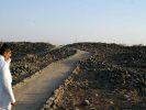
The geographical sources have mentioned the route which begins at Damascus, the capital of the caliphate, and from there towards Al-Sanamayn (the place of the two idols) (1), which is a well-populated village (2), onto Athri’at (3) which is called Dar’a (4), a region on the outskirts of the Levant adjacent to Al-Balqa and Amman (5), and the route heads south until it reaches Al-Zarqa (6), which is a densely populated village located on the Zarqa Valley (7) , and after it is Sargh (8), which is the beginning of the Hijaz and the end of the Levant (9), including a number of wells that provide water to the pilgrims (10).

Figure 4. Map indicating the stations on the Damascus Route to Makkah. Distances not to scale. This map is redrawn from the original found in Nizar Aziz Habib Mahmoud, Khidmat al-Hajij fi-l ‘Asr al-‘Abbasi 132-334 AH, unpublished master’s thesis, College of Arts University of Basra, 1990; Table No. (1). p. 224.
After departing from Sargh, the path reaches Tabuk (11), which has a well and the mosque of the Prophet (peace and blessings be upon him) (12). Tabuk is the midway point between Damascus and Makkah (13).
After Tabuk, the pilgrim’s caravan enters Al-Janinah (14), which is located amidst the houses of Bani Asad (15), and from there to Al-Muhdathah (16), which was later renamed Birkat al-Mu’atham (17). Within it, there is a mountain called Amud al-Muhadathah (18).
The pilgrimage caravan continues until it enters Al-Aqra’ (19), and this location’s name has been retained (20). It is a mountain between Makkah and Madinah (21). The caravan then reaches one of the ancient towns known as Al-Hijr (22), which is a village among the dwellings of Thamud. They depend on wells to obtain water, and within the town, there is a mosque and a market. The name Al-Hijr remains to be well-known and populated (23).
Upon departing, the caravan enters Wadi al-Qura (24), which is a valley between Madinah and the Levant, provincially belonging to Madinah. It is plentiful in its towns, and it contains the dwellings of Qudha’ah, then Juhaynah, Athrah and Baliy (25).
From Wadi al-Qura the caravan enters Al-Suqya (26), short for Suqya al-Jazl, and Al-Jazl is a large valley located within the lands of Athrah, in proximity to Wadi al-Qura (27). After the pilgrim enjoys visiting the grave of the Prophet (peace and blessings be upon him) the caravan continues its journey to Makkah through the Madinah-Makkah route (28). Geographers have differed in determining the distance between Damascus and Madinah due to the difference in the units of measurement used by both of them (29).
The Levantine hajj caravan would leave Madinah following in the footsteps of the Prophet, taking the route of the tree (Tariq al-Shajarah) to Thil Hulaifah which lies approximately 5.5 miles away from Madinah (30).
The route continues until the caravan reaches Al-Hufair after a distance of 6 miles, which is an area distinguished by its plentiful water (31). Although there are many places with such a name, the one mentioned here refers to the one between Madinah and Makkah (32), and Al-Hufair is the dwelling of Bani Fihr from the Quraish (33). After leaving, a distance of 6 miles away the caravan reaches Wadi Malal (34). A distance of 7 miles away the caravan arrives at Al-Siyalah (35) which is a comprehensive village (36) which comprises of a market and an agricultural area known for its palm trees. In addition, the source of its water is its wells (37). After departing Al-Siyalah, the caravan heads to Al-Rawha’ after crossing a distance of 11 miles (38). These are dwellings belonging to Muzaynah (39), and from there to Al-Ruwaytha is a distance of 13 miles (40). It is a comprehensive village (41) which relies on a well and pools for its access to water. It has a body of water known as Al-Ahsa (42). Following this, the caravan continues until it reaches Al-Arj after 14 miles (43), which is Muzaynah’s dwellings (44).
A distance of 17 miles past Al-Arj, the caravan enters Al-Suqya (45), which is a large town close to the sea at a distance of a day and night’s worth of travel away from it (46). In addition to it being an agricultural area with plentiful palm trees and water, with a large number of wells and springs around which vegetation grows (47), it also has a flowing river (48). These are the dwellings of Bani Kinanah (49), and it was said that it was named Al-Saqaya for the freshwater therein (50).
The caravan continues on its way until after 17 miles, it reaches Al-Abwa (51) whose inhabitants are a mix of Arabs (52). After departing it, Al-Juhfa is a distance of 23 miles away (53). It was known as Juhfah because the floods washed it away (54). Al-Juhfa is a focal town close to the sea, relying on wells for the provision of water (55). The most famous nearby site is Ghadir Khum (56), which is from the dwellings of some from Bani Sulaym (57).
24 miles past Al-Juhfah, the caravan would have arrived at Qadid (58), which is a village bustling with inhabitants, containing a number of wells and springs. It is considered a fertile area with many orchards, and dwellings belonging to Khuza’ah (59). It was named Qadid due to the separation of torrents in it (60). After departing from Qadid, the caravan proceeds 23 miles further until its arrival at Asafan (61), which is from the dwellings of Bani al-Mustaliq from Bani Khuza’ah (62).
After a further 23 miles, the caravan arrives at Batn Murr (Arabic مر), the final station of the Madinah–Makkah route. This is a town bustling with inhabitants and numerous palm trees, containing a number of springs and wells with sufficient water for agriculture (63). It is also called Murr al-Thahran as Murr is the village, and Al-Thahran is the valley’s name (64). It was called Murr due to the bitterness of its water. It was also conjectured that it was called Murr as, between Murr and a palm tree, there is a mountain located within the valley with an inscription in white ink that reads: “Murr, except that the letter raa is not connected to the letter mim.”(65) From Batn Murr, the Levantine caravan prepares to enter Makkah a distance of 13 miles away (66).
Historians and geographers have named this route “Tariq al-Jaaddeh” (67), while Ibn Khardathibah named it “Tariq Al-Jaad” (68). The distance between Madinah and Makkah was estimated to be approximately 200 miles (69).
This study has examined historical material from their primary sources, consisting of general history books and geographical sources which described the stages of the (hajj) route and provided a description of its stations. From these is the book Al-Manasik by Al-Harbi (285 AH/898 CE), and after it comes the manuscript titled Manazil Makkah by an unknown author, in addition to the remaining sources which were referred to in the footnotes which I had benefitted from in acquiring important information regarding the stations of the route and the changes that happened in them. The most important of these sources include: Al-A’laq al-Nafisah by Ibn Rustuh (290 AH/902 CE), and Al-Masalik wa-l Mamalik by Ibn Khardathibah (300 AH/912 CE), and Mu’jam ma Ista’jam by Al-Bakri (487 AH/1075 CE), and Mu’jam al-Buldan by Yaqut al-Hamawi (626 AH/1225 CE).
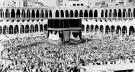
We did not find any indication, even with a subtle hint, of an alternative location for Makkah. All historical sources agree upon its current location and give a clear description of its landmarks which remain present in the same places with most of their historical names unchanged. Such descriptions are also in accordance with the environment and geography of the area. Consequently, there is nothing that prevented historians of the past from indicating if there had been an alternate location for the Ka’bah of Makkah, especially given that they had pointed to the existence of other Ka’bahs in the Arabian Peninsula before the advent of Islam. Moreover, they had emphasised that the Ka’bah of Makkah, the location of which they had clearly specified without any ambiguity, holds sanctity and a lofty status, as they had pointed out to the pilgrimage of the Arab tribes before Islam to the Ka’bah of Makkah.
General history books, histories of cities books and Quranic exegeses all confirm that its historic location is the very one known to us at present. Returning to the Quranic interpretations of verses (133 – 138) in Surah Al-Saffat, (70) we find the consensus holding that the verses came to remind us of the outcome of those who rejected the messages of the prophets, and the verses address all who take this path irrespective of their destination. It is addressed generally to all Arabs, and so the intended audience is not limited to the people of Quraish. Moreover, it would seem to us from the mention of the night and day that it is referring to the time of arrival of the caravans to the ruins of Sodom and Gomorrah in the Dead Sea, in addition to the Levantine route being a route constantly traversed by Arab caravans. The meaning of the night and day is the continuity of the repeated travel of the caravans over the ruins, and this style of figurative expression remains in use in Arab speech. Thus, as the Quran had presented time in a sophisticated rhetorical style, its meanings can only be comprehended through this style (71). It must however be noted that because of the terrain, the northern part of the route is mainly green and with moderate temperatures, it allows for day travel and the caravan would pass the areas near the ruins in the evening. On the other hand, the route from the south is mainly desert. It allows for night travel to avoid the heat of the day. So the caravans coming from the south towards Damascus would bass by the ruins in the morning after camping overnight at a nearby station.
Therefore, these verses advise the Arabs in general, and from them the disbelievers of the Quraish, that it would be better for you to take heed whilst you can see what befell those who rejected the message of the prophets before you, and this is the fate of all who do as they did. Verse 138 ends with the statement (“Will you not reason?”), a call to use the mind to listen to what these ruins say about the power of God (Allah).
Additionally, the historical narrations, in mentioning Makkah before Islam, referred to historical events which had occurred in Makkah’s location which is recognized by all. The most prominent is perhaps the well of Zamzam which continues to gush, and the narrations are in agreement on its current location.
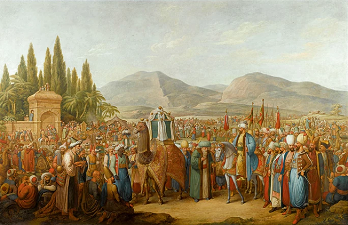
Figure 5. The Arrival of the Mahmal (a ceremony amongst the caravans of pilgrims on the Hajj) at an Oasis En Route to Mecca, by Georg Emanuel Opiz – sothebys.com
Therefore, through this study, we followed the route of the Levant in the corpus of geographic and historical sources available to us and did not come across any reliable proof to verify the line of research which casts doubt on the presence of the Ka’bah in its known location.
It would seem to us that the reason behind this scepticism originates from the lack of research and awareness of reliable historical sources, and incorrectly interpreting the historical texts in favour of a false conclusion.
Hence, we find no justification for those who adopt the line of research which casts doubt on the current location of Makkah in neglecting Islamic geographical sources which did not contain anything to support their doubts except by abandoning the methodology of scientific historical research which necessitates that the researcher forgoes his biases and past ideas. It is also necessary to not neglect those sources mentioned by researchers in historical and geographic studies. Among non-Muslims known to be of a high level of accuracy and credibility are Krachkovsky (72) and the French orientalist Reno (73).
These geographical and travel publications are at the forefront of sources for studying the history of any area or region, and so it is incumbent to return to such works which are considered a treasure due to the authentic and comprehensive information contained therein. It is not possible to deny the authenticity of the knowledge offered by Al-Harbi, Al-Ya’qoubi, Al-Bakri, Ibn Hawqal, or Abul Fida for example (albeit not exhaustively); see references at the end.
Besides geographic information, these works have also provided other information about economic, social, political and doctrinal affairs, and so were helpful for researchers in drawing a general description of these regions.
These publications are indispensable tools for the historian as they grant the researcher the ability of advanced spatial thinking so as to arrive at historical knowledge and extract information from historical narratives. Moreover, they have enabled us to produce maps, even if they were basic, of the paths and routes in what is now known as data mining. The geographic information in these works is priceless.
In summary, it can be said that such publications were following the historical phenomenon from a geographical perspective, for although they were late in doing so, they provided geographic historic information that came before the time of their writing about the areas, and contemporary research has proven them to be of a high standard of confidence in that. These sources firstly mention the geographic location and specify it, and its importance to the region and some climate-related and topographical details about it, then mention what had occurred in it of events prior to the time of the author or even during his time, and also mention the most prominent characters which were famous in each land.
If there had been any doubt regarding the current location of Makkah, the sources would have clearly referred to it or hinted to it one way or another. However, as it did not do so, this is proof of the error of the research trend which casts doubt on the location of Makkah, and which appears to have motives behind it other than rigorous academic research.
Here I must give mention to Dr Amaal Muhammad Al-Roubi, who responded to the orientalist Patricia Crone, and refuted all shreds of evidence mentioned by the orientalist in casting doubt on the location of Makkah (74). Moreover, Nöldeke also commented on the Syriac Annals of Khuzestan, a manuscript which was discovered by the Italian orientalist Ignazio Guidi, translated first by him into Latin and later by Nöldeke into German. The Annals are a Syriac history written by an eastern Christian in the 7th century CE, in which there is mention of the dome of Abraham. The author’s narration in the commentary is seen to be in support of the Islamic story of Abraham, reinforcing that the dome mentioned is the Ka’bah in Makkah (75).

Figure 6. The Egyptian Mahmal on its way to Mecca, c. 1880 – Khalili Collections / CC BY-SA 3.0 igo
The study titled (The Levantine Hajj Route and the Ruins of the People of Lut – A Study of the Islamic Geographical Sources) arrived at a number of conclusions, the most prominent of which are:
The Arabic-Islamic geographic sources gave the location of Makkah a distinguished position in their methodology and did not mention, even by hinting, that the Ka’bah of Ibrahim (peace be upon him) had any location other than Makkah. This is proof that the location is one and remains unchanged, as these sources are characterised by credibility in their historical material. The rejection of these sources by those who cast doubt in the location of the Ka’bah of Ibrahim under the pretext that it came late cannot be explained except by being distant from the academic scientific methodology which necessitates that the researcher does not neglect sources which do not support his view.
It is not from scientific integrity to adopt double standards when dealing with sources that are relied upon in their other studies given the presence of credibility and accountability in them, whilst simultaneously doubting their credibility when they do not find what they seek from it.
Table 1
Damascus – Madinah route (76)
| Al-Harbi (d 285 AH) |
Ibn Rustuh (d 290 AH) |
Al-Ya’qoubi (d 292 AH) |
Ibn Khardabitha (d 300 AH) |
Qudamah bin Ja’far (d 337 AH) |
Al-Maqdisi al-Bishari (d 380 AH) |
Al-Idrisi (d 560 AH) |
| Damascus | Damascus | Damascus | Damascus | Damascus | Tayma’ | Did not refer to this route |
| Al-Sanamayn | Manzil | Eelah | Manzil | Al-Manazil | Al-Hijr | |
| Athri’at | Manzil | Madyan | Manzil | Thaat al-Manazil | Wadi al-Qura | |
| Al-Zarqa | Thaat al-Manazil | Thaat al-Manazil | Sargh | Al-Suqya | ||
| Al-Qastal | Sargh | Sargh | Tabuk | |||
| Qibal | Tabuk | Tabuk | Al-Muhdathah | |||
| Bali’ah | Al-Muhdathah | Al-Muhdathah | Al-Aqru’ | |||
| Al-Hafir | Al-Aqru’ | Al-Aqru’ | Al-Janinah | |||
| Ma’an | Al-Janinah | Al-Janinah | Al-Hijr | |||
| Thaat al-Mathaar | Al-Hijr | Al-Hijr | Wadi al-Qura | |||
| Al-Mughithah | Wadi al-Qura | Wadi al-Qura | Al-Madinah | |||
| Sargh | Al-Rahba | Al-Rahba | ||||
| Tabuk | Thil Marwa | |||||
| Al-Muhdathah | Al-Marr | Al-Marr | ||||
| Al-Aqru’ | Al-Suwayda | Al-Suwayda | ||||
| Al-Janinah | Thi Khashab | Thi Khashab | ||||
| Al-Hijr | Al-Madinah | Al-Madinah | ||||
| Wadi al-Qura | ||||||
| Al-Suqya |
Table 2
Madinah – Makkah route (77)
| Al-Harbi (d 285 AH) |
Ibn Rustuh (d 290 AH) |
Al-Ya’qoubi (d 292 AH) |
Ibn Khardabitha (d 300 AH) |
Qudamah bin Ja’far (d 337 AH) |
Al-Maqdisi al-Bishari |
Al-Idrisi |
| Thil Hulaifah Al-Shajarah (5.5 miles) |
Al-Shajarah (6 mies) |
Thil Hulaifah (4 miles) | Al-Shajarah (6 mies) |
Al-Shajarah (6 mies) |
Yathrib | Al-Shajarah (6 miles) |
| Al Hufair (6 miles) |
Al-Siyala (31 miles) |
Al Hafirah | Malal (12 miles) |
Malal (12 miles) |
Al-Ruwaitha (Marhala) | Malal (12 miles) |
| Malal (6 miles) |
Al-Ruwaitha (34 miles) |
Malal | Al-Siyala (19 miles) |
Al-Siyala (19 miles) |
Al-Rawha’ (Marhala) |
Al-Siyala (17 miles) |
| Al-Siyala (7 miles) |
Al-Arj (14 miles) |
Al-Siyala | Al-Ruwaytha (34 miles) |
Al-Ruwaytha (34 miles) |
Al-Arj (Marhala) | Al-Ruwaytha (34 miles) |
| Al-Rawha (11 miles) |
Al-Suqya (36 miles) |
Al-Rawha | Al-Suqya (36 miles) |
Al-Suqya (36 miles) |
Suqya Bani Ghifar (Marhala) | Al-Suqya (36 miles) |
| Al-Ruwaitha (13 miles) |
Al-Abwa (19 miles) |
Al-Ruwaytha | Al-Abwa (29 miles) |
Al-Abwa (29 miles) |
Al-Abwa (Marhala) | Al-Abwa (27 miles) |
| Al-Arj (14 miles) |
Al-Jahfa (27 miles) |
Al-Arj | Al-Jahfa (27 miles) |
Al-Jahfa (27 miles) | Al-Jahfa (Marhala) | Al-Jahfa (27 miles) |
| Al-Suqya (17 miles) |
Qadid (29 miles) |
Suqya Bani Ghifar | Qadid (27 miles) |
Qadid (26 miles) |
Al-Khaym (marhala) | Qadid (26 miles) |
| Al-Abwa (17 miles) |
Asafan (24 miles) |
Al-Abwa | Asafan (24 miles) |
Asafan (24 miles) |
Khalis Wamij (Marhala) |
Asafan (24 miles) |
| Al-Jahfa (23 miles) |
Batn Marr (34 miles) |
Al-Jahfa | Batn Marr (33 miles) |
Batn Marr (16 miles) |
Asafan (Marhala) |
Batn Marr (33 miles) |
| Qadid (24 miles) |
Makkah (16 miles) |
Qadid | Makkah (16 miles) |
Makkah (16 miles) |
Batn Marr (Marhala) | Makkah (16 miles) |
| Asafan (23 miles) |
Asafan | Makkah (Marhala) | ||||
| Batn Marr (23 miles) |
Marr al-Thahran | |||||
| Makkah (13 miles) |
Makkah |
Footnotes and References
[1] Al-Harbi, Abu Ishaq Ibrahim bin Ishaq bin Ibrahim bin Bashir (d. 285 AH). Al-Manasik wa Amakin wa Turuq al-Hajj wa Na’alim al-Jazira, edited by Hamad Al-Jasser, Dar Al-Yamamah, (Riyadh, 1969), p. 653; Unknown author, a book on The History of Mecca and Medina, Manazil Makkah, a manuscript preserved in the Graduate Studies Library in the College of Arts – University of Baghdad, No. (1587), paper 114b; While some sources called the first place “manzil” see: Ibn Rustah, Abu Ali Ahmed bin Omar (d. 290 AH). Al-A’laq al-Nafisah, (Leiden, 1891), p. 183; Ibn Khordadbeh, Abu al-Qasim Ubaid Allah bin Abdullah (d. 300 AH). Al-Masalik wa-l Mamalik, Al-Muthanna Library, (Baghdad, N.D), p. 150; Some sources mention the name of the first place after leaving Damascus as “Al-Kiswah.” See: Al-Omari, Ibn Fadlallah Shihab al-Din Ahmad bin Yahya (d. 749 AH). Masalik al-Absar fi Mamalik al-Amsar, (Frankfurt, N.D), p. 334; Al-Jaziri, Abdul Qadir Muhammad bin Abdul Qadir bin Muhammad bin Ibrahim Al-Ansari (d. 977 AH); Durar al-Fawa’id al-Munathamah fi Akhbar al-Hajj wa Tariq Makkah al-Mu’athamah, Al-Mutba’a Al-Salafiyyah, (Cairo, 1964)., p. 453; Mosel, A. Northern Hijaz, translated by Abdul Mohsen Al-Husseini (Alexandria, 1952), p. 156; The latter mentioned that the Kiswah is the name of the manzil according to Ibn Rustah and Ibn Khordadbeh. Al-Kiswah is a small village on the Al-Araj River that divides it, and it is located 18 km south of Damascus and its name came from the clothing that Banu Ghassan took from the envoys of the King of the Romans who came to collect tribute from them. See: Al-Zamakhshari, Muhammad bin Omar (d. 578 AH). Al-Amkinah wa-l miyaah wa-l Jibal, investigation by Ibrahim Al-Samarrai, Al-Saadoun Press, (Baghdad, N.D), p198; Al-Dimashqi, Muhammad bin Isa bin Kanaan Al-Salihi (d. 1153 AH). Al-Mawakib al-Islamiyyah fi-l Mamalik wa-l Mahasin al-Shamiyyah, investigation by Hikmat Ismail, Part Two, Publications of the Ministry of Culture, (Damascus, 1993), footnote, p. 352; Bakr, Syed Abdul Majeed. Al-Malamih al-Jughrafiyyah li Duroob al-Hajeej, Dar Tihama (Jeddah, 1981), p. 182; As for Qudama bin Ja’far, Abu al-Faraj bin Qudama bin Ziyad, al-Katib al-Baghdadi (d. 337 AH). Al-Kharaaj wa Sina’at al-Kitabah, edited by Muhammad Hussein Al-Zubaidi, Dar Al-Rasheed Publishing House, (Baghdad, 1981). The first name (Al-Manazil) was mentioned after Damascus. For more details see: Appendix No. (1).
[2] It was mentioned by Al-Hamawi, Shihab Al-Din Abu Abdullah Yaqut bin Abdullah al-Roumi al-Baghdadi, Mu’jam al-Buldan, Dar Sader, (Beirut, 1955). Under the name (Al-Sunyan), it is two stations away from Damascus, and it is among the towns of Damascus in the near part of Hauran, and some believed that Al-Sunyan is the second station on the Levantine hajj route after the Kiswah, and that it is the place that Ibn Rustah and Ibn Khordadbeh referred to, Al-Masalik wa-l Mamalik, p. 150; Al-Omari, Masalik Al-Absar 2/334; Al-Jaziri, Durar al-Fawa’id, p. 453; Malki, Suleiman Abdul Ghani. Tariq Hujjaj al-Shaam wa Misr mundh al-Fath al-Islami ila Muntasaf al-Qarn al-Saabi’ al-Hijri, Al-Dara Magazine, tenth year, first issue, June-1984, p. 9. For more details, see: Table No. (1).
[3] Al-Harbi, Al-Manasik, p. 653; Unknown author, folio 114b; Mossel believed that Athri’at, which is 150 km to the south of Damascus, is the name of the third house, which Ibn Rustah and Ibn Khordadbeh referred to as “Dhaat al-Manazil.” According to Qudamah’s arrangement, Dhaat al-Manazil is the second station. See: Ibn Rustah, Al-A’laq al-Nafisa, p. 183; Ibn Khordadbeh, Al-Masalik wa-l Mamalik, p. 150; Qudamah bin Ja’far, Al-Kharaj, p. 85; Mosel, Northern Hijaz, p. 156; Al-Ya’qoubi mentioned that Jund al-Sham is divided into spheres, and al-Buthaina is one of its spheres, and its city is Athri’at. See: Al-Buldan, pp. 82-83; As for Al-Maqdisi, he divided the region of the Levant into spheres, one of which he called Jordan, and made the spheres one of his cities, and determined the distance between Damascus and the arms of two stages. See: Al-Maqdisi al-Bishari, Shams Al-Din Muhammad bin Ahmed (d. 380 AH). Ahsan al-Taqasim fi Ma’rifat al-Aqalim, 2nd edition (Leiden, 1906)., pp. 154, 192; Dradkeh mentioned that the name of Dhaat al-Manazil indicates the importance of its location in relation to the road. See: Dradkeh, Saleh Musa. The Levantine Hajj Route in the Umayyad Era, 4th international conference on the history of the Levant (The Levant in the Umayyad era), (Amman, 1996), p. 441; Table No. (1).
[4] Dradkeh, Al-Hajj al-Shami Road, p. 441; Al-Aridhi, Wijdan Fareeq Enad. Tariq Umara’ al-Hajj fi al-Dawlah al-‘Arabiyyah al-Islamiyyah, Dar Al-Nahda Al-Arabiya, (Beirut, 2021), p. 30.
[5] Al-Hamawi, Mu’jam al-Buldan, 1/130; Some sources have mentioned that there is a four-day journey between it and Damascus. See: Al-Istakhari, Abu Ishaq Ibrahim bin Muhammad Al-Karkhi (d. fourth century AH), Al-Masalik wa-l Mamalik, (N.P., N.D), p. 49; Ibn Hawqal, Abi Al-Qasim Al-Nasibi (alive during the fourth century AH). Al-Masalik wa-l Mamalik, (N.P., N.D), p. 171.
[6] Al-Harbi, Al-Manasik, p. 653; Unknown author, Manazil Makkah, 114b. Zarqa is 203 km south of Damascus and 110 km north of Medina. See: Al-Dimashqi, Al-Mawakib al-Islamiyyah, vol. 2, footnote, p. 353; Bakr, Al-Malamih al-Jughrafiyyah, p. 186.
[7] Al-Bakri, Abu Obaid Abdullah bin Abdul Aziz Al-Andalusi (d. 487 AH). Jazirat al-‘Arab min Kitab al-Masalik wa-l Mamalik, edited by Abdullah Yusuf al-Ghunaim, Al-Matba’ah al-Asriyyah, (Kuwait, 1977). Mu’jam ma Ista’jam, edited by Mustafa al-Sakka, Part 2, Matba’at Lajnat al-ta’lif wa-l Tarjamah wa-l Nashr, (Cairo, 1945), 2/696; Al-Hamawi, Mu’jam al-Buldan, 3/137.
[8] Some sources mentioned that Sargh is the next manzil of Athri’at (currently Daraa). See: Ibn Rustah, Al-A’laq al-Nafisa, p. 483; Ibn Khordadbeh, Al-Masalik wa-l Mamalik, p. 150; Qudamah bin Ja’far, Al-Kharaj, p. 85; Mussel, Northern Hijaz, pg. 156, and Sargh at Yaqut is located between al-Mughitha and Tabuk, and it is one of the manazil of the Levantine pilgrimage route. See: Al-Hamawi, Mu’jam al-Buldan, 3/212, as well as: Al-Hazmi, Abu Bakr Muhammad bin Musa bin Othman bin Hazim Al-Hamdhani al-Shafi’i (d. 584 e). Ma itafaqa lafthuhu wa iftaraqa musammaah fi-l amakin wa-l buldan al-mushtabah fil khat, a manuscript preserved in the Center for the Revival of the Arab Scientific Heritage No. 53 and the photocopy of the copy of the Sulaymaniyah Library. Manuscript Laleli, No. 2140, sheet 218, currently Sargh is the Jordanian city of Al-Mudawarah, more than 300 km away from Athri’at, and it is difficult for the caravan to continue passing by without stopping for this distance; The sources mentioned the names of seven manazil between Athri’at and Sargh. See: Al-Harbi, Al-Manasik, p. 653; unknown author, Manazil Makkah, folio 114b; It seems that these Manazil are in accordance with the distance, and some of these Manazil still retain traces from the era of the Umayyad Caliphate, and perhaps we can analyze that they were not mentioned by some historians as a matter of disagreement between them concerning the details and characteristics of the manzil in order for it to be considered a manzil in terms of considerations regarding water, grass, the market, and the change in roads. Due to various factors, see: Dradkeh, The Levantine Hajj Route, pp. 441-443. See: Table No. (1).
[9] Al-Hazmi, Ma itafaqa lafthuhu, paper 218; Al-Hamawi, Mu’jam al-Buldan, 3/212.
[10] Al-Bakri, Mu’jam ma Ista’jam, 3/735; Sargh is about 572 km away from Damascus, see: Bakr, Al-Malamih Al-Jughrafiyyah, p. 193.
[11] Ibn Saad, Saad bin Manee (d. 230 AH), Al-Tabaqat al-Kubra, Braille Press, (Liden, 1904), 2/165-168; Al-Istakhari, Abu Ishaq Ibrahim bin Muhammad Al-Karkhi (d. fourth century AH). Al-Aqalim, (Kota, N.D), p. 10; Al-Balkhi, Abu Zaid Ahmed bin Sahl (d. 322 AH). Suwar Al-Aqalim, a manuscript preserved in the Graduate Studies Library, College of Arts, University of Baghdad, No. 329, Paper 20.
[12] Al-Istakhari, Al-Masalik wa-l Mamalik, p. 24; Ibn Hawqal, Sourat al-Ard, p. 39; Al-Maqdisi Al-Bishari, Ahsan Al-Taqasim, p. 179; Al-Hazmi, Ma ittafaqa lafthuh, paper 76; Al-Himyari, Abi Abdullah Muhammad bin Abdul Moneim Al-Sunhaji (d. 727 AH). Al-Rawd al-Mi’tar fi Khabar al-Aqtar, investigation by Ihsan Abbas, 2nd edition, Heidelberg Press, (Beirut, 1984), p. 130; Abu Al-Fida, Ismail bin Ali bin Muhammad (d. 732 AH). Taqwim al-Buldan, (Paris, 1840), p. 87; Al-Dimashqi, Al-Mawakib al-Islamiyyah, Volume 2, margin, p. 354.
[13] Al-Istakhari, Al-Masalik wa-l Mamalik, p. 24; Ibn Hawqal, Sourat al-Ard, p. 39; Al-Dimashqi, Al-Mawakib al-Islamiyyah, Volume 2, margin, p. 354.
[14] When looking at Appendix No. (1), we find that the Al-Junaynah comes after Al-Muhaddithah, and Al-Aqra’, see: Al-Harbi, Al-Manasik, p. 653; Unknown author, Manazil Makkah, folio 114b; Ibn Rustah, Al-A’laq al-Nafisa, p. 183; Ibn Khordadbeh, Al-Masalik wa-l Mamalik, p. 150; Qudamah bin Ja’far, Al-Kharaj, p. 85; However, Mossel concluded from his research in the region that Al-Junaynah came before Muhadditha and Al-Aqra’, see: North Hijaz, p. 156.
[15] Al-Bakri, Mu’jam ma Ista’jam, 2/399.
[16] Al-Harbi, Al-Manasik, p. 653; Ibn Rustah, Al-A’laq al-Nafisa, p. 183; Al-Aridhi, Turuq Umara’ Al-Hajj, p. 32.
[17] Mosel, Northern Hijaz, pg. 156; See: Al-Omari, Masalik al-Absar 2/336; Al-Jaziri, Durar al-Fawa’id, pg. 458.
[18] Al-Zamakhshari, Al-Amkinah wa-l Miyah, p. 65; Al-Hamawi, Mu’jam al-Buldan, 5/60.
[19] Al-Harbi, Al-Manasik, p. 53; Unknown author, Manazil Makkah, folio 114b; Ibn Rustah, Al-A’laq al-Nafisa, p. 183; Ibn Khordadbeh, Al-Masalik wa-l Mamalik, p. 150; Qudama bin Ja’far, Al-Kharaj, p. 85.
[20] This place is about 200 km away from Tabuk in the southeast of Tabuk, see: Mosel, North Hijaz, p. 156.
[21] Al-Hamawi, Mu’jam al-Buldan 1/236.
[22] Al-Harbi, Al-Manasik, p. 656; Qudamah bin Ja’far, Al-Kharaj, p. 85; Al-Hazmi, Ma ittafaqa lafthuhu, paper 134.
[23] Al-Himyari, Al-Rawd al-Mi’tar, p. 189; Al-Omari, Masalik al-Absar, 1/231; See: Al-Istakhari, Al-Aqalim, p. 10; Ibn Hawqal, Sourat al-Ard, p. 39; Al-Zamakhshari, Al-Amkinah wa-l Miyaah wa-l Jibal, p. 72; Abu al-Fida, Taqweem al-Buldan, p. 89; Shawkat, Ibrahim, Jazirat Al-‘Arab min Nuzhat al-Mishtaq li-l Sharif al-Idrisi, Iraqi Scientific Academy Press, (Baghdad, 1971) , p. 33; Bakr, Al-Malamih Al-Jughrafiyyah, pp. 204-206.
[24] Al-Harbi, Al-Manasik, p. 653; unknown author, Manazil Makkah, folio 114b; Ibn Rustah, Al-A’laq al-Nafisa, p. 183; Ibn Khordadbeh, Al-Masalik wa-l Mamalik, p. 150; Lughdah al-Isfahani, Al-Hassan bin Abdullah (310 AH). Bilad Al-‘Arab, investigation by Hamad Al-Jasser and Saleh Ahmed Al-Ali, Dar Al-Yamamah for Research, Translation and Publishing, (Riyadh, 1968), p. 397; Qudama bin Ja’far, Al-Kharaj, p. 85.
[25] Al-Hamawi, Mu’jam al-Buldan, 4/338; Al-Himyari, Al-Rawd Al-Mi’tar, pg. 602.
[26] Al-Harbi, Al-Manasik, p. 653; Unknown author, Manazil Makkah, folio 114b.
[27] Lughdah al-Isfahani, Bilad al-‘Arab, p. 396; Al-Bakri, Mu’jam ma Ista’jam, 3/743; Al-Hamawi, Mu’jam al-Buldan, 3/228.
[28] When looking at Appendix No. (2), we find that Ibn Rustah and Ibn Khordadbeh have referred to the names of other manazil after Wadi Al-Qura, see: Al-A’laq al-Nafisa, p. 183; Ibn Khordadbeh, Al-Masalik wa-l Mamalik, p. 150; While Al-Harbi stopped at the watering station may be due to differences of historians and geographers in defining a place as a manzil.
[29] Some of them estimated the distance at (20 Marhala). See: Al-Istakhari, Al-Masalik wa-l Mamalik, p. 29; Ibn Hawqal, Surat al-ard, p.6; As for Al-Idrisi, he estimated it at (30 Marhala). See: Shawkat, Jazirat Al-‘Arab, p. 30; As for Al-Omari, the distance according to him is 728 miles, or the equivalent of two hundred and forty-two farsakhs, and a third of a farsakh. See: Masalik al-Absar 2/299; As for the distance between Damascus and Medina, Al-Omari estimated it at 580 miles, or the equivalent of ninety-three farsakhs and a third of a farsakh. See: Masalik al-Absar, 2/317.
[30] Al-Harbi, Al-Manasik, pg. 427; unknown author, Manazil Makkah, folio 42a; Geographical sources differed in determining the amount of distance between Medina and Dhul Hulaifa. See: al-Bakri, Mu’jam ma Ista’jam, 2/464; Al-Hamawi, Mu’jam al-Buldan, 2/295; Al-Himyari, Al-Rawd Al-Mi’tar, p. 196; Al-Samhoudi, Nur al-Din Ali Jamal al-Din ‘abul Muhasin Abdullah bin Shihab al-Din bin al-Abaas Ahmad al-Husaini al-Shaaf’ii (d. 911 AH), Wafaa Al-Wafa Al-Samhudi, Bi’akhbar Dar Al-Mustafaa, Arts Press, (Egypt,1326 AH), 2/293; While a recent study estimated the distance between them at 9 km, see: Al-Kandhlawi, Muhammad Zakaria, Hajjat al wada’ wa umraat alnabi salla Allahu alaihi wa sallam, Nadwat al-Ulama Press, (India, N.D.), p. 9.
[31] Al-Harbi, Al-Manasik, pg. 440; See: unknown author, Manazil Makkah, folio 46b; Al-Hazmi, Ma ittafaqa lafthuhu, paper 145.
[32] Al-Bakri, Mu’jam ma Ista’jam, 2/458-459; Al-Hamawi, Mu’jam al-Buldan, 2/277.
[33] Al-Ya’qoubi, Ahmed bin Abi Yaqoub bin Wadh (d. 292 AH). Al-Buldan, 3rd Edition, Al-Haidari Press (Najaf, 1957), p. 73.
[34] Al-Harbi, Al-Manasik, p. 441; Unknown author, Manazil Makkah, folio 46b.
[35] Al-Harbi, Al-Manasik, p. 443; See: unknown author, Manazil Makkah, folio 46b; Al-Bakri, Mu’jam ma Ista’jam, 4/1256; Al-Samhoudi, Wafaa’ al-Wafaa, 2/166.
[36] Al-Hamawi, Mu’jam al-Buldan, 3/292; Al-Himyari, Al-Rawd al-Mi’tar, p. 333.
[37] Ibn Rustah, Al-A’laq al-Nafisa, p. 178; Ibn Khordadbeh, Al-Masalik wa-l Mamalik, p. 130; Al-Himyari, Al-Rawd al-Mi’tar, p. 333; Shawkat, Jazirat al-‘Arab, p. 23.
[38] Al-Harbi, Al-Manasik, p. 443; Al-Samhoudi, Wafaa’ al-Wafaa, 2/166; Historians differed among themselves in determining the distance between Al-Rawha and Al-Madinah. See: Al-Zamakhshari, Al-Amkinah wa-l Miyah wa-l Jibal, p. 114; Al-Himyari, Al-Rawd al-Mi’tar, p. 22, Al-Samhoudi, Wafaa’ al-Wafaa, 2/314. A recent study showed that the area still bears the same name, but it is no longer s station for the pilgrims and is 74 km away from Medina. See: Al-Kandhlawi, Muhammad Zakariyya, Hajjat al-Wada’, Nadwatul Ulama Press, India, p. 30.
[39] Al-Ya’qoubi, Al-Buldan, 2/681.
[40] Al-Harbi, Al-Manasik, p. 445; See: unknown author, Manazil Makkah Paper 48a, Al-Bakri, Mu’jam ma Ista’jam, 2/686.
[41] Al-Bakri, Mu’jam ma Ista’jam, 2/686; Al-Himyari, Al-Rawd al-Mi’tar, p. 277.
[42] Unknown author, Manazil Makkah, folio 48a; Ibn Rustah, Al-A’laq al-Nafisa, p. 178; Ibn Khordadbeh, Al-Masalik wa-l Mamalik, p. 130; Al-Himyari, Al-Rawd Al-Mi’tar, p. 277; Al-Samhoudi, Wafaa’ al-Wafaa, 2/169; Shawkat, Jazirat al-‘Arab, p. 23.
[43] Al-Harbi, Al-Manasik, pg. 447; See: Al-Bakri, Mu’jam ma Ista’jam, 3/903; Al-Hazmi, Ma ittafaqa lafthuhu, paper 275.
[44] Unknown author, Manazil Makkah, folio 48b; Ya’qoubi, Al-Buldan, p. 77.
[45] Al-Harbi, Al-Manasik, p. 448; See: unknown author, Manazil Makkah, folio 49a; Mu’jam ma Ista’jam, 3/742, 931; Al-Himyari, Al-Rawd al-Mi’tar, p. 327.
[46] Al-Hamawi, Mu’jam al-Buldan, 3/ 228; Al-Samhoudi, Wafaa’ al-Wafaa, 2/323.
[47] Al-Harbi, Al-Manasik, pp. 451-452; Unknown author, Manazil Makkah, folio 49b; Ibn Rustah, Al-A’laq al-Nafisa, p. 178; Al-Hamawi, Mu’jam al-Buldan, 3/228; Al-Himyari, Al-Rawd al-Mi’tar, p. 327.
[48] Ibn Khordadbeh, Al-Masalik wa-l Mamalik, p. 130; Qudamah bin Ja’far, Al-Kharaj, p. 80, Shawkat, Jazirat al-‘Arab, p. 23.
[49] Al-Ya’qoubi, Al-Buldan, p. 73.
[50] Al-Harbi, Al-Manasik, p. 450.
[51] Al-Harbi, Al-Manasik, p. 451; See: unknown author, Manazil Makkah Paper 49 b.
[52] Al-Bakri, Mu’jam ma Ista’jam, 1/102.
[53] Al-Harbi, Al-Manasik, p. 454; See: Al-Samhoudi, Wafaa’ al-Wafaa, 2/172.
[54] Al-Harbi, Al-Manasik, p. 457; See: Al-Bakri, Mu’jam ma Ista’jam, 2/368; Al-Himyari, Al-Rawd al-Mi’tar, p. 156.
[55] Al-Harbi, Al-Manasik, p. 457; Ibn Rustah, Al-A’laq al-Nafisa, p. 178; Ibn Khordadbeh, Al-Masalik wa-l Mamalik, p. 131; Qudamah bin Ja’far, Al-Kharaj, p. 81; Shawkat, Jazirat al-‘Arab, p. 23.
[56] Al-Bakri, Mu’jam ma Ista’jam, 2/368; Al-Himyari, Al-Rawd al-Mi’tar, p. 156; Al-Samhoudi, Wafaa’ al-Wafaa, 2/367; Al-Ali, Salih Ahmed, Al-Hijaz fi Sadr al-Islam Dirasat fi ‘Ahwalihi al-Umrania wal-Idaria, muasasat al-Risalati, (Beirut, 1990) , p. 263.
[57] Al-Ya’qoubi, Al-Buldan, p. 73.
[58] Al-Harbi, Al-Manasik, p. 457; See: Al-Himyari, Al-Rawd al-Mi’tar, p. 454.
[59] Al-Harbi, Al-Manasik, pp. 457, 460; Ibn Rustah, Al-A’laq al-Nafisa, p. 178; Ibn Khordadbeh, Al-Masalik wa-l Mamalik, p. 178; Qudamah bin Ja’far, Al-Kharaj, p. 81; Al-Bakri, Mu’jam ma Ista’jim, 3/1054.
[60] Al-Harbi, Al-Manasik, p. 459.
[61] Al-Harbi, Al-Manasik, p. 459; Al-Himyari, Al-Rawd al-Mi’tar, p. 421.
[62] Al-Harbi, Al-Manasik, p. 463; Unknown author, Manazil Makkah, folio 52b; Al-Bakri, Mu’jam ma Ista’jam, 3/942; As for Al-Idrisi, he makes them the dwellings of a people from Bani Juhayna, seen: Shawkat, Jazirat al-‘Arab, p. 23.
[63] Al-Harbi, Al-Manasik, p. 465; Ibn Rustah, Al-A’laq al-Nafisa, p. 178; Ibn Khordadbeh, Al-Masalik wa-l mamalik, p. 131; Qudamah bin Ja’far, Al-Kharaj, p. 81; Al-Hazmi, Ma ittafaqa lafthuhu, paper 354; Shawkat, Jazirat al-‘Arab, p. 23.
[64] Lughdah al-Isfahani, Bilad al-‘Arab, footnote, p. 24; Al-Hazmi, Ma ittafaqa lafthuhu, paper 354; Al-Hamawi, Mu’jam al-Buldan, 5/104 Al-Samhoudi, Wafaa’ al-Wafaa, 2/174.
[65] Al-Harbi, Al-Manasik, p. 465; See: unknown author, Manazil Makkah, folio 53a; Al-Bakri, Mu’jam ma Ista’jam, 4/1212, 1257.
[66] Al-Harbi, Al-Manasik, p. 465; See: unknown author, Manazil Makkah, folio 53a; Al-Bakri, Mu’jam ma Ista’jam, 4/1212; Al-Hamawi, Mu’jam al-Buldan, 5/104; Al-Himyari, Al-Rawd al-Mi’tar, p. 93, and it is 25 km away from Makkah. See: Al-Kandhlawi, Hajjat al-Wada’, p. 40.
[67] Unknown author, Manazil Makkah, folios 16a-16b; Ibn Hawqal, Sourat al-Ard, p. 46; Shawkat, Jazirat al-‘Arab, p. 23.
[68] Al-Masalik wa-l Mamalik, p. 130.
[69] Al-Harbi, Al-Manasik, p. 468; Geographers differed in determining the distance between Medina and Makkah, due to the difference in the unit of measurement used by them. See: Al-Ya’qoubi, Al-Buldan, p. 73, Ibn Hawqal, Sourat al-Ard, p. 46; Al-Istakhari, Al-Masalik wa-l Mamalik, p. 28; As for Al-Idrisi, the amount of the distance according to him is (250) miles, see: Shawkat, Jazirat al-‘Arab, p. 24; While Ibn Fadl Allah al-‘Umari estimated the distance as “one hundred miles and twelve miles, which is thirty-seven farsakh and one-third of a farsakh.” See: Al-Omari, Masalik al-Absar, p. 299; Al-Jaziri, Durar al-Fawa’id, p. 442; acknowledging that the marhalah is eight farasikh, one farsakh is 6 km, and the mile is 2 km.
See: Al-Ya’qoubi, Al-Buldan, footnote, p. 75; Ibn Al-Rafaa, Abu Al-Abbas Najm Al-Din Al-Ansari (d. 710 AH). Al-Idaah wa-l Tabayun fi Ma’rifat al-Mikyal wa-l Mizan, edited by Muhammad Ahmad Ismail Al-Kharouf, Dar Al-Fikr (Damascus, 1980), pp. 77-78; Hunts, Valter. Al-Makayil wa-l Awzan al-Islamiyyah wa ma Yu’adiluha fi al-Nitham al-Mitri, translated by Kamel Al-Asali, Publications of the University of Jordan (N. P, N. D), pp. 94-95.
[70] Al-Tabari, Jami’ al-Bayan ‘an ta’wil aay al-Quran, Dar al-Tarbiyah wa-l Turath, (Makkah, N. D), C 21, p. 105; Al-Qurtubi, Abu Abdullah Muhammad bin Ahmed Al-Ansari, Al-Jami’ Ahkam al-Qur’an, edited by Ahmed Al-Bardouni and Ibrahim Ataqish, Egyptian Book House, (Cairo, 1964), vol. 15, p. 120; Sayyid Qutb, Fi Thilaal al-Quran, 6th Edition, Dar, Al-Shorouk, (Beirut, 1978), Volume 5, p. 2998.
[71] Muhammad bin Musa Baba Ammi, Mafhum al-Zaman fi-l Quran al-Karim, Dar Wahi al-Qalam, (Damascus, 2008), p. 65
[72] Karachowski looked at the writings of the scholars of Islamic civilization with respect and appreciation, and specifically mentioned the geographical sources, saying: “Perhaps this is true above all of the Arab historical and geographical literature, which scholars recognized long ago as the main and reliable source in the study of the Islamic world’s past. In it is an inexhaustible subject, not only for the historian and geographer, but also for sociologists, economists, historians of literature, science and religion, linguists and natural scientists. And the scope of literature is not confined to Arab countries alone, but rather provides us with information on all the countries which the Arabs reached or those which they acquired information on. And this was in the same rich image they had described the lands of Islam. It may sometimes be that the Arab geographical material represents either the sole or the most important source for the history of a specific era for a country.” See: Karachowski, Ignatius Yulia Naqash, History of Arab Geographical Literature, translated by Salah al-Din Osman Hashim The Committee for Authorship, Translation and Publication, League of Arab States, (Cairo, 1963), Part One, p. 3
[73] The French orientalist Reno described Abi Al-Fida’s book, Taqwim al-Buldan, and said: “The European Middle Ages did not know a book that could be compared with it.” See: Krachowski, previous reference, 1/389; Muhammad Mahmoud Muhammadin, Al-Turath al-Jughrafi al-Islami, Dar al-Uloom, (Riyadh, 1999), p. 193.
[74] Amaal Muhammad Al-Roubi , Response to Patricia Crone, Meccan Trade and the Rise of Islam, Princeton: Princeton University Press, 1987
Also republished in Arabic by Amal Muhammad Al-Roubi, Al-Radd ‘ala Tijarat Makkah wa Thuhur al-Islam, (In), 2nd Edition, (Cairo, 2013), pp. 26-30
[75] German version link: https://menadoc.bibliothek.uni-halle.de/…/pageview/865296
[76] See: Mahmoud, Nizar Aziz Habib. Khidmat al-Hajij fi-l ‘Asr al-‘Abbasi 132-334 AH, unpublished master’s thesis, College of Arts University of Basra, 1990; Table No. (1).
[77] See: the same reference, Table No. (2).
Discover the golden
age of Muslim civilisation.
© Copyright FSTC Ltd 2002-2020. All Rights Reserved.