The earliest maps made of America by Columbus have all since been lost. However, a number of very early and accurate maps exist which were made by Piri Reis based on material including the maps by Columbus and used by the Turkish navy.
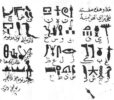
 |
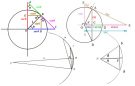
| Coordinates of Piri Reis map |
![]() This short article is taken from the full article which is available here as a PDF file
This short article is taken from the full article which is available here as a PDF file
The discovery of a new continent, America, through the efforts to reach India by sailing around the Cape of Good Hope motivated great improvements in the field of marine geography in the 16th century. The Ottomans were also included in these activities for good reasons because in the 16th century the Ottoman Empire had expanded into three continents; the Black Sea and the Mediterranean were turned into Turkish lakes and Ottoman fleets had started to win victories in the Red Sea and the Indian Ocean. As a result, it became necessary for the Ottomans to improve themselves in marine geography.
A Turkish Admiral Pîrî Reis, with his two world maps and his book Kitâb-i Bahriyye, became one of the most important representatives of marine geography not only in the Ottoman, Empire but in the world as well.
Towards the end of the 15th century, the wealth of European nations depended on sea trade. The nation which knew the new shores and sea routes that the others did not know, gained dominance over sea trade and naturally had the opportunity of becoming the richest nation of Europe. It was for this reason that the Spanish had begun to keep all the maps drawn after Columbus’ first trip and discovery of the New World in the archives of Seville. Very few of these maps were allowed to be copied and then, only by the captains in whom the Spanish had complete confidence. The important maps drawn by famous explorers such as Columbus, Magellan and Cortes were copied, neither printed, nor engraved on copper or wood. The maps that were in circulation were the ones that had slipped through this close surveillance. During this period, quite a few maps and geography books were printed. However, the Spanish burnt them; on the pretext that they were full of errors or that, they disclosed secret information. In the 16th century, the English and French offered a reward of forty ingots of gold for a correctly drawn map of any part of America.[1]
With the disappearance of these maps from the archives of Seville, the map drawn in 1500 by Juan de la Cosa who was with Columbus on his trip to America in 1492 became the oldest map of America found. In this map, America was shown as the eastern coast of Asia.
 |
| Portrait of Pîrî Reis |
The two other well-known maps are those of Cantina and Canneries and are of Spanish origin. Another map that drew interest was the rough sketch by Columbus’ son Bartholomea.[2]
The first map that was printed was the map of Contarini who drew the newly discovered land as the extension of Asia.[3] The second map that showed America was the large-scale world map of Martin Waldseemüller, printed in 1507. Though it was based on the map drawn by Canneries in 1502, it differed from the first map in that America was shown as a separate continent from Asia and was called “America.”[4]
Martin Waldseemüller was born in Radolfzell, educated at Freiberg University, and later appointed as a priest at St. Die. Here, a small group working on cosmography, cartography, and philosophy was formed. The Duke’s secretary, Father Walter Ludd, founded a printing house to publish these studies. Waldseemüller began his studies by putting together the copies of Ptolemy’s maps in Basel and Strasbourg libraries. However, he could not ignore the studies of the Spanish and Portuguese on this subject. He cast Ptolemy aside for Amerigo Vespucci whom he admired and whose book Cosmographiae Introductio he used, in drawing a map of South America. He paid homage to the great explorer calling his map “America.”[5]
While the maps mentioned above have been accepted as the oldest maps of America, in 1929 Halil Eldem found a piece of a map in the Topkapi Place and took it to Ataturk who showed great interest in this map. After many studies, this map, or portolano, was proved to be a part of the world map drawn in 1513 by the famous Turkish Admiral Pîrî Reis.
Pîrî Reis had also mentioned the sources he referred to while drawing this map. One of them, as he mentioned in Kitâb-i Bahriyye, is the map of Columbus. This map is most probably the map Columbus drew in 1498 and sent to Spain. Although it was not very customary to have copies of the original then, there were copies made of this map. However, today neither the original nor can any of its copies be found. The only map that has survived until now is that of Pîrî Reis, who drew it using the map of Columbus as a model.
 |
| A Turkey Republic bank note contains Pîrî Reis’ map |
LIFE OF PÎRÎ REIS
Although the exact date of his birth is not known, it is presumed that Muhyi al-Din Pîrî was born between 1465 and 1470 in Gallipoli, an important naval base along the Marmara coast. His father was Hajji Mehmed; his uncle, one of the famous admirals of the period, Kemal Reis. When Pîrî was about eleven, he joined the crew of his uncle who had started out as a pirate and then joined the Imperial Ottoman fleet. Between 1487 and 1493, Pîrî participated in many naval battles with his uncle. His independent career as naval captain corresponds to his heroic performances in the sea battles between 1499 and 1502. It is probably during one of these battles that he may have gotten hold of the Columbus Map.
After his uncle’s death in 1511, he left the open seas to live in Gallipoli and started working on map drawing. After a while, he joined in the crew of the great Turkish sailor Barbarossa Hayr al-Din.
In 1516-1517, Pîrî Reis was given command of several ships in the Ottoman campaign against Egypt. He showed great prowess in capturing Alexandria which was then the naval base of Egypt. This victory caused Pîrî to gain, the closer notice of Sultan Selim (1519-1520) and to present to him the world map which he had completed in Gallipoli.
After the Egyptian campaign, Pîrî returned to Gallipoli and started to work on the Kitâb-i Bahriyye. In the meanwhile, Selim had died and Sultan Suleyman the Magnificent had ascended the throne; Pîrî was given a commission in the Turkish fleet.
Around this time, there was some disturbance in Egypt and Pîrî Reis was asked to act as a marine guide to Grand Vizier Ibrahim Pasha of Parga who commanded the campaign. During the expedition, they were forced to take refuge at Rhodes due to storms. This gave Pîrî the opportunity of getting to know the Pasha better. Ibrahim Pasha, too, noticed that Pîrî often consulted some notes, that is, the book he was working on, Bahriyye. So, he asked Pîrî to make a proper book out of his notes. Eventually, Pîrî completed the book, with the help of Ibrahim Pasha, presented it to Sultan Suleyman the Magnificent, and won the Sultan’s appreciation. A second world map followed it. Today, only a portion of this map known as the North America map is available.
About that time, the Portuguese had captured Aden. The Ottoman government made Pîrî Reis the Admiral of the Indian Ocean Fleet, and ordered him to take Aden back. Pîrî took Aden back in 1548 and other victories followed this one. These victories had angered his enemies, especially the governor of Basra, Kubat Pasha, who sent word to Istanbul that Pîrî had deserted the fleet at Basra. When the governor of Egypt seconded him, Dukaginzade Mehmed Pasha, Pîrî Reis was sentenced to death and was executed in Cairo in 1555, an old man over eighty.
[1] Brown, L.A., The Story of Maps, Canada 1953, 5th ed., p. 8.
[2] Tooley, R. V., Maps and Map-Makers, London, 1952, 2nd ed., p. no. 110.
[3] Tooley, p. no. 110.
[4] Brown, p. 110.
[5] Brown, p. 157.
Discover the golden
age of Muslim civilisation.
© Copyright FSTC Ltd 2002-2020. All Rights Reserved.